The earliest recorded avalanche fatalities in Canada were registered in 1782, when an avalanche struck an Aboriginal community at Nain, Labrador. The details of many more are lost in the mists of time. Each disaster is a story worth remembering and contains a lesson worth heeding. Today, more people than ever travel through or live near avalanche terrain. History has shown that all need to be aware of the potential danger.
Step back in timeRescuers search for victims of Canada's worst avalanche accident, Glacier National Park, BC, March 1910. © Whyte Museum V263 1659.
Please enable javascript to enhance this content.
Review historical avalanche data
| Date | Location | Lat, Long | Deaths | Category | Subcategory |
|---|---|---|---|---|
| May 31, 2024 | Atwell Peak, Garabaldi, Coastal Mountains Garabaldi British Columbia |
49.83823, -123.00508 | 3 | Recreation | Mountaineering |
| Mar 26, 2024 | La ligne Bleue à la Martre, Eastern Canada Quebec |
49.12842, -66.15081 | 3 | Recreation | Other |
| Mar 10, 2024 | Rocky Mtns Spray Valley Provincial Park, Rocky Mtns Spray Valley Alberta |
50.84232, -115.3116 | 1 | Recreation | Backcountry Skiing, Self-propelled |
| Mar 3, 2024 | snow-biking, Selkirk Mtns,Sale Mtn Sale Mountain British Columbia |
51.1686, -118.13322 | 1 | Recreation | Other |
| Feb 24, 2024 | Gardiner Cr 40 km w Pincher Creek Rocky Mountains Alberta |
49.35867, -114.52119 | 1 | Recreation | Snowmobiling |
| Jan 27, 2024 | Hasler Recreation Area Rocky Mountains British Columbia |
55.37941, -122.33844 | 1 | Recreation | |
| Mar 29, 2024 | Cathedral Mountain Yoho National Park British Columbia |
51.42517, -116.36385 | 1 | Recreation | Backcountry Skiing, Self-propelled |
| Feb 11, 2023 | Potato Peak 44 km SSE Tatla Lake Coastal Mountains British Columbia |
51.5474, -124.3226 | 2 | Recreation | Backcountry Skiing, Self-propelled |
| April 11, 2023 | Treaty Creek Coastal Mountains British Columbia |
56.55711, -130.0123 | 1 | Recreation | Backcountry Skiing, Heli & Cat |
| Mar 1, 2023 | Coppercrown Mtn Purcell Mountains British Columbia |
50.28909, -116.30243 | 3 | Recreation | Backcountry Skiing, Heli & Cat |
| Jan 9, 2023 | 15km NNW Kaslo, BC Selkirk Mountains British Columbia |
50.02811, -117.01244 | 2 | Recreation | Backcountry Skiing, Self-propelled |
| Jan 21, 2023 | 35 km S Valemont Cariboo Mountains British Columbia |
52.51756, -119.21224 | 1 | Recreation | Snowmobiling |
| Feb 16, 2023 | Terminator 2.5 8 km SW Golden Purcell Mountains British Columbia |
51.27083, -117.0613 | 2 | Recreation | Backcountry Skiing, Self-propelled |
| Jan 23, 2023 | Akokalex 24 km SE Revelstoke Selkirk Mountains British Columbia |
50.90871, -117.84963 | 2 | Recreation | Backcountry Skiing, Heli & Cat |
| Apr 15, 2023 | Thunderwater Lake Purcell Mountains British Columbia |
50.65355, -116.60074 | 1 | Recreation | Snowmobiling |
| Apr 22, 2023 | Lake Louise ski run closed Rocky Mountains Alberta |
51.46751, -116.14576 | 1 | Recreation | Backcountry Skiing, Self-propelled |
| Nov 11, 2023 | Ice-climbing in Peter Lougheed Provincial Park Rocky Mountains Alberta |
50.76341, -115.29147 | 1 | Recreation | Mountaineering |
| Mar 6, 2022 | Eastern Canada Charlie's Bottom Newfoundland |
49.00353, -58.19920 | 1 | Recreation | Snowmobiling |
| Apr 13, 2022 | Rocky Mtns Mount des Poilus British Columbia |
51.59449, -116.60635 | 1 | Recreation | Mountaineering |
| Apr 5, 2022 | Coastal Mtns Whistler British Columbia |
50.0658, -122.96648 | 1 | Recreation | Downhill Resort Skiing |
| Feb 5, 2022 | Coastal Mountains Cassiope Peak British Columbia |
50.36474, -122.57058 | 1 | Recreation | Backcountry Skiing, Self-propelled |
| Feb 20, 2022 | Coastal Mountains Mount Kenney British Columbia |
54.58473, -128.93884 | 1 | Recreation | Backcountry Skiing, Heli & Cat |
| Apr 5, 2021 | Rocky Mountains Haddo Peak British Columbia |
51.38329, -116.23453 | 1 | Recreation | Backcountry Skiing, Self-propelled |
| Nov 27, 2021 | Rocky Mountains 17 km from Powder King Hasler Area British Columbia |
55.36622, -122.34096 | 1 | Recreation | Snowmobiling |
| May 30, 2021 | Rocky Mountains Mount Andromeda-Skyladder British Columbia |
52.17836, -117.24785 | 2 | Recreation | Snowmobiling |
| Mar 4, 2021 | Selkirk Mountains Reco Mountain British Columbia |
49.99979, -117.18904 | 1 | Recreation | Snowmobiling |
| Mar 29, 2021 | Cariboo Mountains Eureka Peak British Columbia |
52.33517, -120.69033 | 1 | Recreation | Snowmobiling |
| Nov 7, 1950 | trapping furs Rocky Mountains British Columbia |
57.815305, -130.671998 | 2 | Recreation | |
| Feb 1, 1929 | 0.5 km from Reno Mine Selkirk Mountains British Columbia |
49.181836, -117.131524 | 1 | Industry | Mining |
| Feb 22, 1981 | Bourgeau Lake Alberta |
51.14058, -115.79522 | 1 | Recreation | Backcountry Skiing, Self-propelled |
| Mar 17, 1977 | Groovy CMH Bugaboos British Columbia |
50.70724, -116.62874 | 3 | Recreation | Backcountry Skiing, Heli & Cat |
| Mar 19, 1977 | Bow Peak Banff National Park Alberta |
51.64063, -116.37861 | 1 | Recreation | Mountaineering |
| Mar 21, 1977 | Tooth Chutes outside Apex Alpine Ski Area British Columbia |
49.39333, -119.91861 | 1 | Recreation | Downhill Resort Skiing |
| Mar 27, 1977 | Quartz Ridge British Columbia |
51.02386, -115.76188 | 1 | Recreation | Backcountry Skiing, Self-propelled |
| Mar 30, 1977 | Flush Bowl outside Lake Louise Ski Area Alberta |
51.44059, -116.09524 | 1 | Recreation | Downhill Resort Skiing |
| Oct 09, 1977 | President's Glacier British Columbia |
51.50729, -116.56199 | 1 | Recreation | Mountaineering |
| Jan 29, 1978 | Chelmsford Ontario |
46.58812, -81.19069 | 1 | Recreation | Other |
| Feb 11, 1978 | 40 km south-west of Mica Creek British Columbia |
51.77113, -118.99208 | 4 | Recreation | Backcountry Skiing, Heli & Cat |
| Aug 20, 1978 | 3-3.5 Couloir Moraine Lake Alberta |
51.30724, -116.19527 | 1 | Recreation | Mountaineering |
| Dec 16, 1978 | Dennis Creek Slocan Lake area British Columbia |
50.04052, -117.39564 | 1 | Recreation | Backcountry Skiing, Self-propelled |
| Feb 14, 1979 | Spillimacheen Range Golden area British Columbia |
51.10729, -117.06214 | 7 | Recreation | Backcountry Skiing, Heli & Cat |
| Feb 20, 1979 | Between Back Bowl and Burnt Stew Basin outside Whistler Mountain Ski Area British Columbia |
50.12405, -122.96337 | 1 | Recreation | Backcountry Skiing, Self-propelled |
| Feb 23, 1979 | near peak Mount Mackenzie British Columbia |
50.974, -118.07903 | 1 | Recreation | Backcountry Skiing, Heli & Cat |
| Feb 23, 1981 | Crystalline Drainage British Columbia |
50.8389, -116.914 | 3 | Recreation | Backcountry Skiing, Heli & Cat |
| Feb 24, 1979 | Stanley Basin British Columbia |
51.20724, -116.06192 | 2 | Recreation | Backcountry Skiing, Self-propelled |
| Feb 28, 1979 | Tangle Hill Alberta |
52.26194, -117.29583 | 1 | Recreation | Mountaineering |
| Mar 17, 1979 | Windy Pass Gold Bridge area British Columbia |
51.0075, -122.94663 | 1 | Recreation | Snowmobiling |
| Jan 12, 1982 | railway mile 43.5 Terrace British Columbia |
54.25779, -129.44781 | 1 | Transportation | Trails, Roads and Highways |
| Mar 15, 1980 | meadow above timberline Mount Mackenzie British Columbia |
51.97407, -118.07893 | 1 | Recreation | Backcountry Skiing, Heli & Cat |
| Aug 08, 1980 | Slesse Mountain British Columbia |
49.02394, -121.5965 | 1 | Recreation | Mountaineering |
| Aug 20, 1980 | Mount Athabasca Alberta |
52.19066, -117.21205 | 1 | Recreation | Mountaineering |
| Feb 18, 1981 | Derickson Ridge Revelstoke area British Columbia |
51.19067, -118.42907 | 1 | Recreation | Backcountry Skiing, Heli & Cat |
| Feb 21, 1981 | Waterfall Valley British Columbia |
51.57392, -116.56198 | 1 | Recreation | Backcountry Skiing, Self-propelled |
| Feb 22, 1981 | Mount Thompson Alberta |
51.666, -116.513 | 2 | Recreation | Mountaineering |
| Apr 02, 1981 | Mount Stephen British Columbia |
50.82394, -116.99548 | 2 | Recreation | Mountaineering |
| Mar 06, 1981 | Mount Thompson Alberta |
51.67399, -116.51196 | 2 | Recreation | Mountaineering |
| Feb 15, 1977 | Park Parker Ridge Banff National Park Alberta |
52.19069, -117.12871 | 1 | Recreation | Backcountry Skiing, Self-propelled |
| Mar 16, 1977 | Table Mountain Ridge Diana Lake British Columbia |
50.90728, -116.22865 | 1 | Recreation | Backcountry Skiing, Heli & Cat |
| Apr 23, 1972 | Apex Basin Ymir Mountain British Columbia |
49.44055, -117.1123 | 1 | Recreation | Backcountry Skiing, Self-propelled |
| Feb 13, 1977 | Chateau-Richer Quebec |
46.96667, -71.01667 | 1 | Recreation | Other |
| Feb 19, 1972 | East ridge Mount Edith Cavel Alberta |
52.67408, -118.04553 | 3 | Recreation | Mountaineering |
| Dec 28, 1965 | Kootenay Pass British Columbia |
49.09049, -117.01231 | 1 | Transportation | Trails, Roads and Highways |
| Jan 01, 1966 | Red Pass British Columbia |
52.9908, -118.99569 | 2 | Transportation | Trails, Roads and Highways |
| Jan 08, 1966 | Macdonald West #2 slidepath on Trans-Canada Highway Rogers Pass British Columbia |
51.30727, -117.51221 | 2 | Transportation | Trails, Roads and Highways |
| Jan 30, 1967 | Mount Whitehorn, Ptarmigan Chutes outside Lake Louise Ski Area Alberta |
51.47394, -116.12858 | 1 | Recreation | Downhill Resort Skiing |
| Dec 09, 1967 | Parker Ridge Alberta |
52.19069, -117.12871 | 1 | Recreation | Backcountry Skiing, Self-propelled |
| Dec 15, 1968 | Cap-Diamant Quebec |
46.80917, -71.20194 | 1 | Recreation | Other |
| Mar 23, 1969 | Mount Hector Alberta |
51.575, -116.25944 | 1 | Recreation | Backcountry Skiing, Self-propelled |
| Dec 27, 1969 | Mine Bell Thetford Mines Quebec |
46.1, -71.3 | 1 | Other | Unknown |
| Jan 24, 1970 | Westcastle Ski Area west of Pincher Creek Alberta |
49.31905, -114.41522 | 1 | Recreation | Downhill Resort Skiing |
| Aug 11, 1971 | Mount St. Elias Yukon |
60.30813, -140.93378 | 4 | Recreation | Mountaineering |
| Dec 23, 1971 | 30 km east of Fernie British Columbia |
49.50706, -114.62848 | 3 | Transportation | Trails, Roads and Highways |
| Dec 23, 1971 | Squaw Basin outside Granite Mountain British Columbia |
49.10718, -117.8458 | 1 | Recreation | Downhill Resort Skiing |
| Feb 05, 1972 | Highland Creek Scarborough Ontario |
43.77122, -79.14094 | 2 | Recreation | Other |
| Mar 05, 1972 | Mascot Mine 6 km east of Hope British Columbia |
49.39069, -121.44644 | 3 | Transportation | Trails, Roads and Highways |
| Jan 31, 1977 | Thetfort Mines Quebec |
46.1, -71.3 | 1 | Industry | Mining |
| Apr 08, 1972 | Burnt Stew Basin outside Whistler Mountain Ski Area British Columbia |
50.07404, -122.9467 | 4 | Recreation | Downhill Resort Skiing |
| Feb 05, 1982 | Polar Circus Cirrus Mountain Alberta |
52.17403, -116.97868 | 1 | Recreation | Mountaineering |
| Mar 14, 1973 | Nine Mile Mountain 10 km north-east of Hazelton British Columbia |
55.35787, -127.49728 | 1 | Recreation | Snowmobiling |
| Dec 09, 1973 | Bow Summit Alberta |
51.70728, -116.49529 | 1 | Recreation | Backcountry Skiing, Self-propelled |
| Jan 22, 1974 | North Route Café on highway 16 45 km west of Terrace British Columbia |
54.39113, -129.13106 | 7 | Transportation | |
| Feb 07, 1974 | Bonnet Plume Range Yukon |
64.75832, -132.99802 | 1 | Recreation | Mountaineering |
| Feb 17, 1974 | Mica Mountain Cariboo Mountains British Columbia |
52.89081, -119.52915 | 1 | Recreation | Backcountry Skiing, Heli & Cat |
| Mar 30, 1974 | Lookout Mountain outside Sunshine Ski Area Alberta |
51.09059, -115.74521 | 1 | Recreation | Downhill Resort Skiing |
| Aug 29, 1974 | Mount Weisshorn St Elias Range Yukon |
60.27485, -138.89987 | 2 | Recreation | Mountaineering |
| Jan 14, 1976 | Cap Sante - Comte Portneuf Quebec |
46.67071, -71.7732 | 1 | Recreation | Other |
| Jan 16, 1976 | 2 km west of summit Kootenay Pass British Columbia |
49.059, -117.044 | 3 | Transportation | Trails, Roads and Highways |
| Mar 23, 1976 | Paradise Basin Invermere area British Columbia |
50.45722, -116.32872 | 1 | Recreation | Backcountry Skiing, Self-propelled |
| Dec 12, 1976 | Chancellor Peak Yoho National Park British Columbia |
51.22392, -116.51201 | 3 | Recreation | Mountaineering |
| Dec 28, 1976 | Comte Dubuc 5 km east of Tadoussac Quebec |
48.15387, -69.62274 | 1 | Recreation | Snowmobiling |
| Jan 18, 1982 | CMH ski run 69 Bugaboos British Columbia |
50.70728, -116.61209 | 2 | Recreation | Backcountry Skiing, Heli & Cat |
| Feb 11, 1984 | Redfern Lake British Columbia |
57.35786, -123.89632 | 2 | Recreation | Snowmobiling |
| Feb 22, 1982 | Marmot Basin Ski Area Jasper National Park Alberta |
52.79071, -118.11218 | 1 | Recreation | Backcountry Skiing, Self-propelled |
| Feb 22, 1990 | Hartly Creek Fernie area British Columbia |
49.55715, -115.00628 | 1 | Recreation | Other |
| Feb 20, 1988 | Fossil Mountain near Lake Louise Ski Area Alberta |
51.50732, -116.04636 | 2 | Recreation | Mountaineering |
| Mar 22, 1988 | Sale Mountain La Forme Creek area British Columbia |
52.78745, -118.10674 | 1 | Recreation | Backcountry Skiing, Heli & Cat |
| Apr 03, 1988 | 1 km north-east of ski area outside Whitetooth Ski Area, Golden area British Columbia |
51.2855, -117.0508 | 1 | Recreation | Downhill Resort Skiing |
| Dec 28, 1988 | Extra Light Ice Climb Field area British Columbia |
51.40734, -116.45647 | 1 | Recreation | Mountaineering |
| Jan 02, 1989 | Christmas Chute outside Blackcomb Ski Area British Columbia |
49.99982, -122.75131 | 1 | Recreation | Downhill Resort Skiing |
| Jan 04, 1989 | south of Westcastle Ski Area Middle Kootenay Pass Alberta |
49.26711, -114.39617 | 1 | Recreation | Snowmobiling |
| Jan 28, 1989 | slope above west part of town Telegraph Creek British Columbia |
57.90791, -131.1599 | 1 | Other | Unknown |
| Mar 15, 1989 | Flute Mountain outside Whistler Mountain Ski Area British Columbia |
50.05722, -122.94803 | 1 | Recreation | Downhill Resort Skiing |
| Mar 15, 1989 | Bella Vista Monashee Mountains British Columbia |
51.79756, -118.65363 | 1 | Recreation | Backcountry Skiing, Heli & Cat |
| Jan 06, 1990 | Wawa Bowl outside Sunshine Ski Area Alberta |
51.10727, -115.79634 | 1 | Recreation | Downhill Resort Skiing |
| Jan 28, 1990 | Snow Valley Main Study Plot, 8.5 km north-north-west of Fernie Sand Creek British Columbia |
49.48718, -115.17632 | 1 | Recreation | Backcountry Skiing, Heli & Cat |
| Jan 30, 1990 | headwaters of Nutla Creek north-north-west of Battleship Kokanee Glacier Park British Columbia |
49.76722, -117.17674 | 2 | Recreation | Backcountry Skiing, Self-propelled |
| Feb 11, 1990 | 2nd avy slope Healy Creek Alberta |
51.1073, -115.82634 | 4 | Recreation | Backcountry Skiing, Self-propelled |
| Jan 20, 1991 | Rummel Col above Rummel Lake, Kananaskis Country Alberta |
50.83723, -115.30624 | 1 | Recreation | Backcountry Skiing, Self-propelled |
| Feb 07, 1988 | Just BTL 1 km north of Crowfoot Pass Alberta |
51.61728, -116.39643 | 1 | Recreation | Backcountry Skiing, Self-propelled |
| Feb 05, 1991 | Charlevoix Riviere-Malbaie Quebec |
0, 0 | 1 | Recreation | Other |
| Mar 12, 1991 | Bugaboos Creek British Columbia |
50.71732, -116.67656 | 9 | Recreation | Backcountry Skiing, Heli & Cat |
| Apr 09, 1991 | East Col Blackcomb Glacier on route to Spearhead Glacier outside Blackcomb Ski Area British Columbia |
50.10738, -122.85801 | 1 | Recreation | Downhill Resort Skiing |
| Nov 27, 1991 | Twin Falls, frozen waterfall 200 m high draining Hudsons Bay Glacier Hudsons Bay Mountain, Smithers area British Columbia |
54.78768, -127.15888 | 1 | Recreation | Mountaineering |
| Jan 03, 1992 | just south-east of Terrace city limits Mount Thornhill British Columbia |
54.48772, -128.4292 | 2 | Recreation | Snowmobiling |
| Feb 26, 1992 | Silk Tassel ice climb Field area British Columbia |
51.40737, -116.44646 | 1 | Recreation | Mountaineering |
| Apr 22, 1992 | Mount Dagon Monarch Icefields south-east of Bella Coola British Columbia |
51.98752, -126.0987 | 2 | Recreation | Backcountry Skiing, Self-propelled |
| Dec 13, 1992 | ecological reserve south of Sicamous Owl's Head Mountain British Columbia |
50.85738, -118.94708 | 1 | Recreation | Snowmobiling |
| Dec 19, 1992 | north-east facing bowl above Australian gully, Mount Strachan outside Cypress Bowl Ski Area British Columbia |
49.41739, -123.19811 | 1 | Recreation | Downhill Resort Skiing |
| Dec 25, 1992 | above Hilda Creek Hostel Parker Ridge Alberta |
52.18739, -117.12656 | 1 | Recreation | Backcountry Skiing, Self-propelled |
| Feb 18, 1993 | Tadousac mountains Quebec |
48.184, -69.6988 | 1 | Recreation | Other |
| Mar 07, 1993 | Mount Skookum Carcross area Yukon |
60.20795, -135.48118 | 1 | Recreation | Snowmobiling |
| Mar 10, 1993 | Bourne Glacier 70 km north-west of Revelstoke British Columbia |
51.31741, -118.57697 | 1 | Recreation | Snowmobiling |
| Mar 17, 1993 | just below pass Bruins Pass British Columbia |
51.30736, -117.57674 | 1 | Recreation | Backcountry Skiing, Self-propelled |
| Feb 13, 1988 | Shawinigan Quebec |
46.55427, -72.73946 | 1 | Recreation | Other |
| Jan 17, 1988 | Standfast Creek British Columbia |
50.91736, -117.87682 | 1 | Recreation | Backcountry Skiing, Heli & Cat |
| Jun 11, 1982 | north ridge Mount Logan Yukon |
60.64149, -140.3503 | 3 | Recreation | Mountaineering |
| Dec 27, 1984 | Wawa Bowl Outside Sunshine Ski Area Alberta |
51.10727, -115.79634 | 1 | Recreation | Downhill Resort Skiing |
| Aug 19, 1982 | Crescent Glacier British Columbia |
50.75727, -116.77878 | 1 | Recreation | Mountaineering |
| Aug 20, 1982 | west bowl Mount Robson British Columbia |
53.12414, -119.14571 | 2 | Recreation | Mountaineering |
| Aug 22, 1982 | Grand Central couloir Mount Kitchener Alberta |
52.21667, -117.33333 | 1 | Recreation | Mountaineering |
| Nov 01, 1982 | Lower Lefroy and Victoria Glaciers Lake Louise area Alberta |
51.37396, -116.26194 | 1 | Recreation | Mountaineering |
| Nov 27, 1982 | Mount Sheer Britannia Beach area British Columbia |
49.62402, -123.06343 | 1 | Recreation | Other |
| Jan 08, 1983 | Apex Alpine Area British Columbia |
49.383, -119.904 | 1 | Recreation | Downhill Resort Skiing |
| Feb 13, 1983 | Tent Ridge, Grizzly Basin Kananaskis Country Alberta |
50.84055, -115.37848 | 1 | Recreation | Backcountry Skiing, Heli & Cat |
| Jul 03, 1983 | Base 3-3.5 Couloir Moraine Lake Alberta |
51.30724, -116.19527 | 1 | Recreation | Mountaineering |
| Sep 18, 1983 | Mount Charlton Alberta |
52.62407, -117.4954 | 1 | Recreation | Mountaineering |
| Jan 07, 1984 | Quartz Ridge Golden area British Columbia |
51.39061, -117.27882 | 1 | Recreation | Snowmobiling |
| Jan 29, 1984 | 5 km west of the Continental Divide Flathead Pass British Columbia |
49.45708, -114.66182 | 1 | Recreation | Snowmobiling |
| Feb 18, 1965 | Granduc Mine 30 km north-west of Stewart British Columbia |
56.24121, -130.09786 | 26 | Industry | Mining |
| Apr 01, 1984 | Super Couloir Route Deltaform Mountain British Columbia |
51.30167, -116.24528 | 1 | Recreation | Mountaineering |
| Dec 29, 1984 | Mount Neptune Rossland area British Columbia |
49.23724, -117.85693 | 2 | Recreation | Backcountry Skiing, Heli & Cat |
| Aug 01, 1987 | below the Kain face Mount Robson British Columbia |
53.11747, -119.14697 | 1 | Recreation | Mountaineering |
| Feb 18, 1985 | Mount Duffy (Parbury) 6 km north-east of Blue River British Columbia |
52.16746, -119.15703 | 2 | Recreation | Backcountry Skiing, Heli & Cat |
| Feb 23, 1985 | Onion Mountain Smithers area British Columbia |
54.88766, -126.82879 | 1 | Recreation | Snowmobiling |
| Mar 02, 1985 | 4 km south of North Fork Pass Mount Erris British Columbia |
49.88718, -114.67617 | 1 | Recreation | Snowmobiling |
| Mar 03, 1985 | Montange Blanche Charlevoix MountainsMontange Blanche Quebec |
51.60376, -67.1977 | 1 | Recreation | Backcountry Skiing, Self-propelled |
| Jan 25, 1986 | Mount White Queen 1 km north of Whitewater Ski Area British Columbia |
49.45723, -117.12676 | 1 | Recreation | Backcountry Skiing, Self-propelled |
| Feb 04, 1986 | 19 km east of Nakusp Selkirk Mountains British Columbia |
50.25733, -117.99689 | 2 | Recreation | Backcountry Skiing, Heli & Cat |
| Feb 07, 1986 | Curling Corner Brook area Newfoundland |
48.95518, -57.95161 | 1 | Recreation | Other |
| Feb 17, 1986 | 200 m above the highway, 2 km south-west of Coquihalla Lakes Coquihalla Lakes area British Columbia |
49.63736, -120.9976 | 1 | Recreation | Backcountry Skiing, Self-propelled |
| Mar 29, 1986 | Clemina Creek Valemount area British Columbia |
52.56744, -119.09699 | 4 | Recreation | Snowmobiling |
| Jul 05, 1986 | Temple Mountain Alberta |
51.35056, -116.20667 | 2 | Recreation | Mountaineering |
| Aug 28, 1986 | Mount Baker Wapta Icefield Alberta |
51.63944, -116.52639 | 2 | Recreation | Mountaineering |
| Mar 23, 1987 | Thunder River drainage 15 km north-north-east of Blue River British Columbia |
52.25745, -119.34708 | 7 | Recreation | Backcountry Skiing, Heli & Cat |
| May 29, 1987 | near old lookout Bow Summit Alberta |
51.70731, -116.49644 | 1 | Recreation | Backcountry Skiing, Self-propelled |
| Jun 14, 1987 | east flank of north-east ridge Mount Bryce British Columbia |
52.0574, -117.3066 | 3 | Recreation | Mountaineering |
| Feb 28, 1965 | Lone Pine ski run outside Mount Norquay Ski Area Alberta |
51.19055, -115.6285 | 1 | Recreation | Downhill Resort Skiing |
| Jul 11, 1955 | Sentinel Pass Mount Temple Alberta |
51.33972, -116.22111 | 7 | Recreation | Mountaineering |
| Jan 13, 1965 | Mount Caro Marion Ocean Falls British Columbia |
52.35764, -127.69752 | 7 | Buildings/Town | Town/Service Building |
| Mar 08, 1900 | Noble Five Mine Sandon British Columbia |
49.98893, -117.2008 | 2 | Industry | Mining |
| Mar 31, 1897 | Antoine Mine Slocan British Columbia |
50.00222, -117.19972 | 1 | Industry | Mining |
| Apr 04, 1897 | Slocan Milling Company Tram Slocan British Columbia |
50.01239, -117.28413 | 3 | Industry | Mining |
| Nov 14, 1897 | Red Fox Mine British Columbia |
50.00278, -117.19306 | 1 | Industry | Mining |
| Feb 22, 1898 | Three Forks Slide Sandon British Columbia |
50.01306, -117.28516 | 1 | Industry | Mining |
| Feb 22, 1898 | Lévis South Quebec Quebec |
46.8, -71.18333 | 4 | Buildings/Town | Town/Service Building |
| Feb 27, 1898 | Silverton Area Slide British Columbia |
49.96389, -117.28056 | 1 | Industry | Mining |
| Apr 03, 1898 | Silverton Area Slide British Columbia |
49.96389, -117.28056 | 1 | Transportation | Mining |
| Apr 03, 1898 | Chilkoot Pass Alaska, USA |
59.6922371, -135.2392066 | 68 | Transportation | Trails, Roads and Highways |
| Dec 09, 1898 | Crater Lake Chilkoot Pass British Columbia |
59.70644, -135.22324 | 6 | Transportation | Trails, Roads and Highways |
| Dec 10, 1898 | Millie Mack Mine Burton British Columbia |
50.06028, -117.72722 | 2 | Industry | Mining |
| Jan 01, 1899 | Ajax Mine Sandon British Columbia |
49.99306, -117.20667 | 1 | Industry | Mining |
| Jan 30, 1899 | Canadian Pacific Railway snowshed Rogers Pass British Columbia |
51.34066, -117.4622 | 1 | Transportation | Railways |
| Jan 31, 1899 | Canadian Pacific Railway station Rogers Pass British Columbia |
51.3157, -117.5058 | 7 | Transportation | Railways |
| Mar 09, 1900 | Trout Lake British Columbia |
50.64722, -117.53889 | 1 | Industry | Mining |
| Jan 08, 1896 | Abbott Group Mines Lardo-Duncan British Columbia |
50.62935, -117.15865 | 2 | Industry | Mining |
| Mar 11, 1900 | east of the summit Rogers Pass British Columbia |
51.3258, -117.46523 | 1 | Transportation | Railways |
| Apr 28, 1900 | Lardeau-Duncan mining area British Columbia |
49.9058, -116.91655 | 2 | Industry | Mining |
| May 06, 1900 | Alamo Basin Idaho Group British Columbia |
49.972, -117.30127 | 2 | Industry | Mining |
| Dec 20, 1900 | Idaho Basin Mine British Columbia |
49.972, -117.30127 | 1 | Industry | Mining |
| Dec 25, 1902 | Molly Gibson Mine Selkirk Mountains British Columbia |
49.73519, -117.14791 | 9 | Industry | Mining |
| Jan 25, 1904 | Canadian Pacific Railway Revelstoke British Columbia |
50.99069, -118.24572 | 1 | Transportation | Railways |
| Jan 30, 1904 | 50 km north of Squamish Coastal Mountains British Columbia |
50.67415, -123.49677 | 1 | Industry | Trapping |
| Apr 11, 1904 | Canadian Pacific Railway Revelstoke British Columbia |
50.99068, -118.22905 | 2 | Transportation | Railways |
| Jan 12, 1905 | St-Sauveur Ville de Quebec Quebec |
46.81111, -71.23639 | 1 | Recreation | Other |
| Jan 22, 1907 | Devlin Group of mines Salmo British Columbia |
49.20714, -117.26236 | 1 | Industry | Mining |
| Feb 07, 1907 | Coal Creek Fernie British Columbia |
49.44722, -114.99694 | 1 | Industry | Mining |
| Apr 12, 1907 | American Boy Mine Sandon British Columbia |
49.99278, -117.20417 | 1 | Industry | Mining |
| Apr 13, 1908 | Downie Slide on the Canadian Pacific Railway Albert Canyon British Columbia |
51.19606, -117.74774 | 4 | Transportation | Railways |
| Jan 15, 1909 | Saddle Rock area Fraser Canyon British Columbia |
49.63917, -121.40694 | 2 | Transportation | Railways |
| Jan 21, 1897 | Ibex Mine British Columbia |
50.07191, -117.11251 | 1 | Industry | Mining |
| Feb 02, 1895 | Noble Five Mine Sandon British Columbia |
49.98893, -117.2008 | 1 | Industry | Mining |
| Jan 01, 1910 | Burgeo Newfoundland |
47.61667, -57.61667 | 1 | Other | Unknown |
| Jan 06, 1873 | exact location unknown Trinity Newfoundland |
48.36667, -53.36667 | 1 | Buildings/Town | Town/Service Building |
| Feb 04, 1825 | Saint-Joseph de Lévis Pointe Lévis Quebec |
46.8, -71.13333 | 5 | Other | Unknown |
| Mar 18, 1830 | Kingaite Northumberland Inlet Nunavut |
62.81367, -67.25668 | 1 | Recreation | Hunting/Fishing |
| May 24, 1833 | exact location unknown Carbonear Newfoundland |
47.73333, -53.21667 | 1 | Other | Various |
| Feb 01, 1840 | exact location unknown Chateau-Richer Quebec |
46.96667, -71.01667 | 1 | Other | Unknown |
| Dec 18, 1843 | Ville de Quebec Cap Blanc Quebec |
46.80308, -71.20897 | 1 | Other | Unknown |
| Feb 01, 1852 | exact location unknown Promontoir de Quebec Quebec |
46.80014, -71.21597 | 7 | Buildings/Town | Town/Service Building |
| Feb 05, 1856 | Big Pond Cape Breton Nova Scotia |
45.90909, -60.53551 | 5 | Buildings/Town | Town/Service Building |
| Jan 16, 1863 | exact location unknown Lévis Quebec |
46.8, -71.18333 | 2 | Other | Unknown |
| Mar 12, 1863 | Distress Cove (St. Brides) Placentia Bay Newfoundland |
46.91764, -54.1654 | 2 | Recreation | Hunting/Fishing |
| Mar 11, 1865 | Saint-Nicholas Lévis Quebec |
46.8, -71.18333 | 1 | Other | Unknown |
| Feb 26, 1866 | exact location unknown Les Eboulements Quebec |
47.48333, -70.31667 | 1 | Buildings/Town | Town/Service Building |
| Feb 16, 1869 | exact location unknown Lévis Quebec |
46.8, -71.18333 | 1 | Buildings/Town | Town/Service Building |
| Mar 11, 1869 | exact location unknown Lévis Quebec |
46.8, -71.18333 | 4 | Buildings/Town | Town/Service Building |
| Feb 03, 1875 | exact location unknown Promontoir de Quebec Quebec |
46.80014, -71.21597 | 8 | Buildings/Town | Town/Service Building |
| Jan 23, 1895 | Bluff Head Brook Chromite Mine Newfoundland |
48.7833, -58.6167 | 4 | Industry | Mining |
| Feb 25, 1876 | Curzon Village Woody Point Newfoundland |
49.51667, -57.91667 | 3 | Buildings/Town | Town/Service Building |
| Feb 09, 1877 | exact location unknown Betts Cove Newfoundland |
49.8192, -55.77171 | 6 | Industry | Mining |
| Feb 12, 1879 | Saint-David Lévis Quebec |
46.8, -71.18333 | 1 | Other | Unknown |
| Jan 26, 1884 | exact location unknown Betts Cove Newfoundland |
49.36916, -55.42181 | 1 | Industry | Mining |
| Feb 04, 1885 | near the western boundary of present-day Glacier National Park Rogers Pass route British Columbia |
51.21027, -117.71216 | 1 | Transportation | Railways |
| Feb 06, 1885 | near Mount Cheops in present-day Glacier National Park Rogers Pass route British Columbia |
51.26362, -117.53617 | 1 | Transportation | Railways |
| Feb 08, 1885 | McDermot's Camp west of the summit Rogers Pass route British Columbia |
0, 0 | 3 | Transportation | Railways |
| Feb 25, 1885 | in present-day Glacier National Park Rogers Pass British Columbia |
51.29063, -117.51221 | 6 | Transportation | Railways |
| Feb 28, 1887 | east of Rogers Pass summit Glacier National Park British Columbia |
51.31817, -117.49322 | 6 | Transportation | Railways |
| Feb 15, 1890 | exact location unknown Conne River Newfoundland |
47.90889, -55.69861 | 2 | Other | Various |
| Jan 20, 1891 | Ireland's Eye Ireland's Bight (Hare Bay) Newfoundland |
51.21, -55.46 | 3 | Buildings/Town | Town/Service Building |
| Jan 04, 1893 | Freddie Lee Mine Slocan British Columbia |
49.96528, -117.20667 | 2 | Industry | Mining |
| Mar 12, 1893 | exact location unknown Murdering Corner Newfoundland |
53.7, -57.01667 | 3 | Recreation | Other |
| Jan 10, 1895 | exact location unknown Eureka Mine British Columbia |
49.73555, -116.91195 | 1 | Industry | Mining |
| Jan 15, 1909 | Canadian Pacific Railway Three Valley Lake British Columbia |
50.934, -118.455 | 2 | Transportation | Railways |
| Feb 04, 1910 | Lorne Creek British Columbia |
54.88083, -128.38722 | 1 | Industry | Trapping |
| Jan 01, 1965 | Darcy - Lillooet area British Columbia |
50.74077, -122.24651 | 1 | Other | Unknown |
| Jan 14, 1950 | Hell's Gate Fraser River British Columbia |
49.79064, -121.44642 | 1 | Transportation | Railways |
| Mar 12, 1936 | Petite-Riviere-Saint-Francois Quebec |
47.30308, -70.56897 | 5 | Other | Unknown |
| Mar 12, 1936 | Baie-Saint-Paul - Charlevoix Quebec |
47.45, -70.5 | 1 | Other | Unknown |
| Feb 11, 1937 | Canadian Pacific Railway Illecillewaet British Columbia |
51.18349, -117.75612 | 2 | Transportation | Railways |
| Feb 24, 1937 | Sandon British Columbia |
49.9755, -117.22696 | 1 | Buildings/Town | Town/Service Building |
| Mar 01, 1937 | Canadian Pacific Railway Rogers Pass British Columbia |
51.29063, -117.51221 | 1 | Transportation | Railways |
| Dec 31, 1937 | Mount Schaffer Yoho National Park British Columbia |
51.34446, -116.3401 | 1 | Recreation | Backcountry Skiing, Self-propelled |
| Mar 21, 1938 | Elysium Pass 20 km west of Jasper Alberta |
52.95472, -118.33944 | 2 | Recreation | Backcountry Skiing, Self-propelled |
| Feb 11, 1943 | McLean Point, Kwinitsa Skeena Valley British Columbia |
54.22451, -129.58117 | 3 | Transportation | Trails, Roads and Highways |
| Feb 19, 1944 | Nigel Peak Banff National Park Alberta |
52.24, -117.17 | 1 | Recreation | Backcountry Skiing, Self-propelled |
| Mar 26, 1945 | Mount Richardson Lake Louise Alberta |
51.49057, -116.12858 | 1 | Recreation | Backcountry Skiing, Self-propelled |
| Jul 22, 1947 | Serra Peaks area Mount Waddington British Columbia |
51.39316, -125.20589 | 1 | Recreation | Mountaineering |
| Dec 30, 1948 | Upper Capilano Vancouver British Columbia |
49.49076, -123.11345 | 1 | Other | Unknown |
| Feb 23, 1949 | Hoodoo Curve Boston Bar British Columbia |
49.82406, -121.42975 | 1 | Transportation | Trails, Roads and Highways |
| Mar 07, 1950 | St-Francois-de-Pabos Quebec |
48.38061, -64.62988 | 1 | Recreation | Other |
| Mar 12, 1936 | Les Eboulements Quebec |
47.48333, -70.31667 | 1 | Transportation | Trails, Roads and Highways |
| Mar 27, 1955 | Seymour Inlet north-west of Vancouver British Columbia |
51.07426, -127.16414 | 1 | Industry | Logging |
| May 24, 1993 | Hummingbird Ridge Mount Logan Yukon |
60.56786, -140.35265 | 1 | Recreation | Mountaineering |
| Mar 11, 1956 | Marmot Basin Jasper National Park Alberta |
52.79071, -118.1122 | 1 | Recreation | Backcountry Skiing, Self-propelled |
| Mar 17, 1957 | Richardson Ridge Near Lake Louise Alberta |
51.4739, -116.1119 | 1 | Recreation | Backcountry Skiing, Self-propelled |
| Mar 23, 1957 | Woodbury Creek British Columbia |
49.752, -116.912 | 1 | Transportation | Trails, Roads and Highways |
| Nov 23, 1958 | Bow Summit Banff National Park Alberta |
51.72391, -116.4953 | 2 | Recreation | Backcountry Skiing, Self-propelled |
| Feb 16, 1959 | The Battery St Johns Newfoundland |
47.56887, -52.67218 | 5 | Buildings/Town | Town/Service Building |
| Mar 24, 1959 | McGillivray Pass British Columbia |
50.69079, -122.59658 | 2 | Recreation | Backcountry Skiing, Self-propelled |
| Apr 07, 1959 | Torbit Mine Alice Arm British Columbia |
55.47452, -129.54777 | 1 | Industry | Mining |
| Jul 30, 1960 | Mount Waddington British Columbia |
51.37418, -125.2471 | 4 | Recreation | Mountaineering |
| Jul 19, 1961 | Mount Garibaldi British Columbia |
49.85737, -122.99673 | 1 | Recreation | Mountaineering |
| Jan 21, 1962 | Outside Silver Star Ski Area Purcell Mountains British Columbia |
50.37395, -119.0626 | 1 | Recreation | Downhill Resort Skiing |
| Feb 06, 1962 | Griquet Northern Peninsula Newfoundland |
51.53333, -55.46667 | 1 | Other | Unknown |
| Dec 30, 1962 | North-east slope of Mount Whaleback Yoho National Park British Columbia |
51.54061, -116.52865 | 1 | Recreation | Backcountry Skiing, Self-propelled |
| Mar 12, 1936 | Saint-Tite-des-Caps Quebec |
47.13333, -70.76667 | 4 | Other | Unknown |
| Mar 04, 1935 | Curling Road Corner Brook Newfoundland |
48.9527, -57.93866 | 3 | Buildings/Town | Town/Service Building |
| Mar 04, 1910 | 17 Shed on the Canadian Pacific Railway Rogers Pass British Columbia |
51.28713, -117.51602 | 58 | Transportation | Railways |
| Mar 22, 1915 | Jane Camp; combined rock and snow avalanche; +/- 100m Britannia Mine British Columbia |
49.61286, -123.14086 | 57 | Industry | Mining |
| Mar 05, 1910 | Washington Slocan Mine British Columbia |
50.00549, -117.21893 | 1 | Industry | Mining |
| Dec 12, 1910 | Silver Cup Mine Skeena District British Columbia |
55.35111, -127.51611 | 1 | Industry | Mining |
| Mar 09, 1911 | Flint and Granite King Mines British Columbia |
49.92834, -117.10783 | 1 | Industry | Mining |
| Oct 05, 1911 | Ben My Chree Mine British Columbia |
59.43168, -134.46574 | 2 | Industry | Mining |
| Dec 23, 1911 | Noble Five Mine Sandon British Columbia |
49.99051, -117.22894 | 1 | Industry | Mining |
| Jan 14, 1912 | Exact location unknown Rogers Pass British Columbia |
51.3, -117.5167 | 1 | Transportation | Railways |
| Mar 11, 1912 | Baie Verte Tilt Cove Newfoundland |
49.88333, -55.63333 | 5 | Industry | Mining |
| Mar 12, 1912 | Baie-Saint-Paul Quebec |
47.45, -70.5 | 1 | Other | Unknown |
| Dec 30, 1912 | Coal Creek Fernie British Columbia |
49.49047, -114.96188 | 6 | Industry | Mining |
| Jan 06, 1913 | Noble Five Mine Sandon British Columbia |
49.99051, -117.22894 | 3 | Industry | Mining |
| Jan 07, 1913 | Alamo Mine Sandon British Columbia |
49.99051, -117.22894 | 1 | Industry | Mining |
| Jan 08, 1913 | Reco Mine Sandon British Columbia |
49.98083, -117.18611 | 1 | Industry | Mining |
| Jan 14, 1913 | Coal Creek Fernie British Columbia |
49.49047, -114.96188 | 1 | Industry | Mining |
| Jan 12, 1917 | Exact location unknown Hazelton British Columbia |
55.2578, -127.66399 | 2 | Industry | Mining |
| Mar 01, 1935 | Okak Labrador Newfoundland |
57.55306, -61.95296 | 2 | Buildings/Town | Town/Service Building |
| Dec 31, 1917 | Humber River Shellbird Island Newfoundland |
48.95272, -57.85532 | 1 | Transportation | Railways |
| Nov 10, 1918 | Mountain Con Mine Silverton British Columbia |
49.92722, -117.14556 | 2 | Industry | Mining |
| Feb 07, 1921 | The Battery St. John's Newfoundland |
47.56887, -52.67218 | 1 | Buildings/Town | Town/Service Building |
| Feb 17, 1921 | Signal Hill St. John's Newfoundland |
47.56887, -52.67218 | 1 | Buildings/Town | Town/Service Building |
| Feb 19, 1927 | Dam Mountain Coastal Mountains British Columbia |
49.394167, -123.081111 | 1 | Recreation | Backcountry Skiing, Self-propelled |
| Feb 24, 1927 | Extenuate Mine Stewart area British Columbia |
55.99125, -129.93117 | 1 | Industry | Mining |
| Dec 17, 1927 | Porter Idaho Mine Marmot River area Porter Idaho Mine British Columbia |
55.87458, -129.94784 | 1 | Industry | Mining |
| Feb 19, 1930 | Canadian Pacific Railway at the Downie Slide Albert Canyon British Columbia |
51.19606, -117.74774 | 2 | Transportation | Railways |
| Feb 24, 1933 | Duchesnay Pass British Columbia |
51.3739, -116.42865 | 2 | Recreation | Backcountry Skiing, Self-propelled |
| Apr 07, 1933 | Fossil Mountain Alberta |
51.50306, -116.04611 | 1 | Recreation | Backcountry Skiing, Self-propelled |
| Dec 24, 1934 | Teddy Glacier Mine Camborne area British Columbia |
50.868, -117.748 | 2 | Industry | Mining |
| Jan 07, 1935 | Taseko-Motherlode Mine Chilcotin Ranges British Columbia |
51.0797, -123.4168 | 7 | Industry | Mining |
| Jan 23, 1935 | Cloister on the Canadian Pacific Railway Golden area British Columbia |
51.3, -116.9 | 1 | Transportation | Railways |
| Jan 24, 1935 | Clanwilliam Slide west of Revelstoke British Columbia |
50.968, -118.362 | 3 | Buildings/Town | Town/Service Building |
| Mar 20, 1993 | Slipstream, east face Snow Dome, Columbia Icefields Alberta |
52.18741, -117.3066 | 3 | Recreation | Mountaineering |
| Feb 24, 1995 | Bankhead Gully (Urs Hole) on south face Mount Cascade Alberta |
51.2673, -115.57628 | 2 | Recreation | Mountaineering |
| Aug 09, 1993 | Aemmer Couloir, north-east ridge Mount Temple Alberta |
51.35726, -116.20642 | 1 | Recreation | Mountaineering |
| Dec 29, 2011 | location accuracy unknown Duffy Lake Road area British Columbia |
50.360118, -122.367145 | 1 | Recreation | Backcountry Skiing, Self-propelled |
| Mar 19, 2010 | 1 km north-east of Eagle Pass Mountain Three Valley Gap area British Columbia |
0, 0 | 1 | Recreation | Snowmobiling |
| Mar 20, 2010 | Azure River Drainage British Columbia |
52.3635, -119.504 | 2 | Recreation | Backcountry Skiing, Heli & Cat |
| Mar 31, 2010 | Y Coulior Mount Currie British Columbia |
50.24861, -122.78194 | 1 | Recreation | Backcountry Skiing, Self-propelled |
| Apr 05, 2010 | north-west of Invermere British Columbia |
0, 0 | 1 | Recreation | Snowmobiling |
| Apr 11, 2010 | Slims River Valley, Observation Mountain Kluane Ranges, St Elias Mountains Yukon |
60.8397, -138.444 | 1 | Recreation | Backcountry Skiing, Self-propelled |
| Dec 28, 2010 | Illal Mountain, south-east shoulder Coquihalla Summit British Columbia |
49.5394, -121.037 | 1 | Recreation | Snowmobiling |
| Jan 15, 2011 | Burstall Pass Kananaskis Country Alberta |
50.76167, -115.37556 | 2 | Recreation | Backcountry Skiing, Self-propelled |
| Jan 16, 2011 | Mount Tanal, east aspect, approximately 45-60 minute walk from Kokanee Glacier Lodge British Columbia |
49.781, -117.198 | 1 | Recreation | Backcountry Skiing, Self-propelled |
| Jan 23, 2011 | Albright Ridge Pyramid Mountain area, north Rockies British Columbia |
55.13861, -121.03694 | 1 | Recreation | Snowmobiling |
| Feb 05, 2011 | Microwave Tower Snowmobile area Smithers area British Columbia |
54.4225, -127.265 | 1 | Recreation | Snowmobiling |
| Feb 19, 2011 | Hope Creek Snowmobile Area north-west of Mount Gerald, north of Golden British Columbia |
51.7392, -117.252 | 3 | Recreation | Snowmobiling |
| Feb 26, 2011 | Tom George Mountain Smithers area British Columbia |
54.4569, -127.67 | 2 | Recreation | Backcountry Skiing, Self-propelled |
| Nov 13, 2011 | Upper Torpy River North Rockies British Columbia |
54.0294, -121.213 | 1 | Recreation | Snowmobiling |
| Dec 30, 2011 | Holyk Creek 32 km south-east of Revelstoke British Columbia |
50.88278, -117.91639 | 1 | Recreation | Backcountry Skiing, Heli & Cat |
| Feb 14, 2010 | South-east of Bewes Creek trailhead Malakwa area British Columbia |
51.0845, -118.525 | 1 | Recreation | Snowmobiling |
| Jan 06, 2012 | Molars Dogtooth Range British Columbia |
51.18, -117.06 | 1 | Recreation | Backcountry Skiing, Self-propelled |
| Feb 03, 2012 | Meadow Mountain Meadow Creek area British Columbia |
50.26, -117.069 | 1 | Recreation | Backcountry Skiing, Heli & Cat |
| Feb 17, 2012 | Raft Mountain Clearwater area British Columbia |
51.745, -119.804 | 1 | Recreation | Backcountry Skiing, Self-propelled |
| Mar 06, 2012 | Grizzly Lake Coast Mountains British Columbia |
50.1278, -123.255 | 1 | Recreation | Snowmobiling |
| Mar 09, 2012 | 30 km south-east of 18 km mark on the Corbin Road south-east of Sparwood British Columbia |
49.27, -114.43 | 1 | Recreation | Snowmobiling |
| Mar 11, 2012 | Ghost Peak McKay Creek, Revelstoke area British Columbia |
50.9258, -118.035 | 1 | Recreation | Backcountry Skiing, Self-propelled |
| Mar 21, 2012 | Bonnington Range Blewett area British Columbia |
49.475, -117.4083 | 2 | Recreation | Backcountry Skiing, Heli & Cat |
| Feb 18, 2013 | east of Jumbo Mountain Invermere area, Purcell Mountains British Columbia |
50.3996, -116.53517 | 1 | Recreation | Backcountry Skiing, Heli & Cat |
| Feb 22, 2013 | Birthday C area outside Revelstoke Mountain Resort British Columbia |
50.969, -118.082 | 1 | Recreation | Downhill Resort Skiing |
| Mar 23, 2013 | Hellroaring Creek area Kimberley area, Purcell Mountains British Columbia |
49.4763, -116.277 | 1 | Recreation | Snowmobiling |
| Mar 24, 2013 | Sifton Col area Rogers Pass, Glacier National Park British Columbia |
51.3292, -117.557 | 1 | Recreation | Backcountry Skiing, Self-propelled |
| Oct 23, 2013 | near KMS camp, Sulphurets Creek area Coastal Mountains British Columbia |
56.5156, -130.2312 | 1 | Industry | Mining |
| Dec 20, 2013 | outside Kicking Horse Mountain Resort Purcell Mountains British Columbia |
51.27354, -117.0592 | 1 | Recreation | Downhill Resort Skiing |
| Jan 18, 2014 | Goat Ridge Monashee Mountains British Columbia |
52.5433, -118.923 | 1 | Recreation | Snowmobiling |
| Mar 13, 2010 | Turbo Hill Boulder Mountain British Columbia |
50.99121, -118.45322 | 2 | Recreation | Snowmobiling |
| Jan 18, 2010 | Queest Mountain British Columbia |
50.98694, -118.87056 | 1 | Recreation | Snowmobiling |
| Feb 15, 2014 | Rowe Peak Watertown Lakes National Park Alberta |
49.0459, -114.048 | 1 | Recreation | Backcountry Skiing, Self-propelled |
| Dec 31, 2008 | Ruby Bowl, closed run Blackcomb Ski Area British Columbia |
50.10085, -122.89819 | 1 | Recreation | Downhill Resort Skiing |
| Jan 01, 2008 | Hanging Roll above West Bowl, permanent closure Whistler Mountain Ski Area British Columbia |
50.06896, -122.9616 | 1 | Recreation | Downhill Resort Skiing |
| Jan 06, 2008 | near Granby Wilderness 80 km north of Grand Forks British Columbia |
49.58384, -118.48748 | 1 | Recreation | Snowmobiling |
| Jan 06, 2008 | Christina Valley Midway - Mount Arthurs British Columbia |
49.70967, -118.59641 | 1 | Recreation | Snowmobiling |
| Jan 06, 2008 | Parachute Bowl Big White Ski Area British Columbia |
49.75002, -118.93019 | 1 | Recreation | Downhill Resort Skiing |
| Jan 07, 2008 | mapped +/- 100 m; Lake Louise area, Banff National Park Mount St. Piran Alberta |
51.418636, -116.244883 | 1 | Recreation | Backcountry Skiing, Self-propelled |
| Jan 16, 2008 | Canyon Creek south of Golden and Kicking Horse Mountain Resort British Columbia |
51.24111, -117.10494 | 1 | Recreation | Backcountry Skiing, Self-propelled |
| Feb 01, 2008 | Koko Claims Elkford area British Columbia |
50.12175, -115.02368 | 1 | Recreation | Snowmobiling |
| Feb 16, 2008 | Keystone Basin 50 km north of Revelstoke British Columbia |
51.45453, -118.33248 | 1 | Recreation | Snowmobiling |
| Feb 18, 2008 | Boom Mountian, below subpeak, Chickadee Valley Kootenay National Park British Columbia |
51.25895, -116.10404 | 1 | Recreation | Backcountry Skiing, Self-propelled |
| Mar 21, 2008 | Bell Mine trails Thetford Mines Quebec |
46.08249, -71.29198 | 1 | Other | Unknown |
| Mar 27, 2008 | headwaters of North Blue River approximately 18 km north-west of Blue River British Columbia |
52.22564, -119.48729 | 1 | Recreation | Snowmobiling |
| Aug 28, 2008 | Mount Athabasca Alberta |
52.19366, -117.20704 | 2 | Recreation | Mountaineering |
| Dec 28, 2008 | near Harvey Pass south-east of Fernie British Columbia |
49.2658, -114.725 | 8 | Recreation | Snowmobiling |
| Jan 01, 2009 | outside early season boundary, Hidden Chutes Whistler Mountain Ski Area British Columbia |
50.11722, -122.95472 | 1 | Recreation | Downhill Resort Skiing |
| Jan 15, 2010 | 2.5 km south of McGillivary Pass Lodge Bendor Range British Columbia |
0, 0 | 1 | Recreation | Backcountry Skiing, Self-propelled |
| Jan 08, 2009 | Mount Alice Terrace area British Columbia |
54.63639, -128.93944 | 1 | Recreation | Backcountry Skiing, Heli & Cat |
| Jan 11, 2009 | Mount Mara, north-east Hunters Range Sicamous area British Columbia |
50.7635, -118.841 | 1 | Recreation | Snowmobiling |
| Jan 11, 2009 | Hasler Flats, Hasler Road km 45, location +/- 25 km Chetwyn area British Columbia |
55.60842, -121.97209 | 1 | Recreation | Snowmobiling |
| Jan 14, 2009 | Third Sister, south-west bowl Kananaskis Country, Canmore area Alberta |
51.00826, -115.28851 | 1 | Recreation | Other |
| Jan 16, 2009 | Clemina Creek Valemount area British Columbia |
52.3186, -118.578 | 1 | Recreation | Snowmobiling |
| Jan 17, 2009 | Babcock Mountain Tumbler Ridge area British Columbia |
54.5138, -121.019 | 1 | Recreation | Snowmobiling |
| Mar 07, 2009 | Ozone, permanent avalanche closure Kicking Horse Mountain Resort British Columbia |
51.2819, -117.094 | 2 | Recreation | Downhill Resort Skiing |
| Mar 21, 2009 | Whitewater Creek Blue River area British Columbia |
52.18306, -119.24139 | 1 | Recreation | Snowmobiling |
| Mar 24, 2009 | Renshaw Creek near McBride area British Columbia |
53.5072, -123.052 | 2 | Recreation | Snowmobiling |
| Mar 25, 2009 | Hellroaring Creek Forest Service road 20 km south of Kimberly British Columbia |
49.4763, -116.277 | 1 | Recreation | Snowmobiling |
| Mar 27, 2009 | Valley of the Lakes approximately 20 km south-west of Parson British Columbia |
50.9183, -117.058 | 1 | Recreation | Snowmobiling |
| Apr 10, 2009 | Clemina Creek Valemount area British Columbia |
52.56528, -119.105 | 1 | Recreation | Snowmobiling |
| Apr 14, 2009 | Mont Medaille Secteur lacs Ste-Marthe et de la Savane dans l'arrière-pays de La Martre (environ 12 km au SO de La Martre) Quebec |
49.0989, -66.2343 | 1 | Recreation | Backcountry Skiing, Self-propelled |
| Jan 04, 2010 | Mount Mackie Rossland area British Columbia |
49.1447, -117.492 | 1 | Recreation | Backcountry Skiing, Self-propelled |
| Feb 15, 2014 | Boulder Mountain Monashee Mountains British Columbia |
50.9988, -118.328 | 2 | Recreation | Snowmobiling |
| Feb 23, 2014 | Lightning Strike Ridge,Twin Lakes Kootenay Pass British Columbia |
49.02, -117.03 | 2 | Recreation | Backcountry Skiing, Self-propelled |
| Dec 07, 2007 | North-east Tent Ridge Spray Lakes area, Kananaskis Country Alberta |
50.84512, -115.36758 | 2 | Recreation | Backcountry Skiing, Self-propelled |
| Mar 16, 2019 | Rocky Mountains Pharoh Lake Alberta |
51.11454, -115.91476 | 1 | Recreation | Backcountry Skiing, Self-propelled |
| Dec 31, 2017 | Selkirk Mountains Kootenay Pass British Columbia |
49.0794, -117.064 | 1 | Recreation | Backcountry Skiing, Heli & Cat |
| Jan 05, 2018 | Eastern Canada Ste-Angèle-de-Mérici Quebec |
48.5284, -68.1172 | 1 | Recreation | Snowmobiling |
| Jan 08, 2018 | Rocky Mountains McDermott Basin, east of Jaffray British Columbia |
49.3564, -115.081 | 1 | Recreation | Backcountry Skiing, Self-propelled |
| Jan 30, 2018 | Selkirk Mountains Clemina Creek British Columbia |
52.5616, -118.9505 | 1 | Recreation | Snowmobiling |
| Feb 09, 2018 | Rocky Mounains Hospital Creek British Columbia |
51.368038, -116.913509 | 1 | Recreation | Snowmobiling |
| Feb 10, 2018 | Coastal Mountains Callaghan Upper Soo Valley British Columbia |
50.22974, -123.269628 | 1 | Recreation | Snowmobiling |
| Mar 28, 2018 | Coastal Mountains Rutherford/South Creek British Columbia |
50.48347, -123.2845 | 1 | Recreation | Backcountry Skiing, Heli & Cat |
| Jan 03, 2019 | Coastal Mountains Pebble Creek area British Columbia |
50.72111, -123.23722 | 1 | Recreation | Backcountry Skiing, Self-propelled |
| Jan 12, 2019 | Purcell Mountains Mount Brewer British Columbia |
50.37333, -116.2238888 | 2 | Recreation | Snowmobiling |
| Jan 26, 2019 | Eastern Canada Nain Newfoundland |
56.52566, -61.69503 | 1 | Recreation | Snowmobiling |
| Feb 09, 2019 | Monashee Mountains Oventop Peak area British Columbia |
52.33495, -118.8943 | 1 | Recreation | Snowmobiling |
| Feb 18, 2019 | Coastal Mountains Runner Peak British Columbia |
49.3937, -122.9434 | 1 | Recreation | Other |
| Mar 11, 2019 | Rocky Mountains Massey's Waterfall 2 km NE Field British Columbia |
51.40409, -116.46689 | 1 | Recreation | Mountaineering |
| Apr 16, 2019 | Rocky Mountains Howse Peak Alberta |
51.813, -116.66922 | 3 | Recreation | Mountaineering |
| Mar 12, 2017 | snowshoeing
Rocky Mountains
Banff National Park Mount Hector British Columbia |
51.605, -116.299 | 2 | Recreation | Other |
| Apr 20, 2019 | Rocky Mountains Mount des Poilus British Columbia |
51.59123, -116.60428 | 1 | Recreation | Backcountry Skiing, Self-propelled |
| Dec 30, 2019 | Coastal Mountains Chuck Creek British Columbia |
59.70228, -136.60222 | 2 | Recreation | Backcountry Skiing, Self-propelled |
| Jan 04, 2020 | Cascade Mountains Cabin Lake British Columbia |
49.97211, -121.22597 | 1 | Recreation | Snowmobiling |
| Jan 10, 2020 | Rocky Mountains Mount Hector Alberta |
51.55546, -116.27115 | 1 | Recreation | Backcountry Skiing, Self-propelled |
| Feb 02, 2020 | Northern Rocky Mountains Upper Burnt British Columbia |
55.27017, -122.3103 | 1 | Recreation | Snowmobiling |
| Feb 13, 2020 | Rocky Mountains Willmore Wilderness Park Alberta |
53.50768, -118.78414 | 1 | Recreation | Snowmobiling |
| Feb 19, 2020 | Eastern Canada Joe Louis run in Mines Madeleine, in Gaspésie Quebec |
49.01584, -66.01389 | 1 | Recreation | Backcountry Skiing, Self-propelled |
| Mar 14, 2020 | Coastal Mountains Brunswick Mountain British Columbia |
49.48825, -123.20532 | 1 | Recreation | Other |
| Nov 28, 2020 | Bijou Falls area Pine Pass British Columbia |
55.29895, -122.72537 | 1 | Recreation | Snowmobiling |
| Dec 28, 2020 | Coastal Mountains Railway Pass British Columbia |
50.59447, -123.00861 | 2 | Recreation | Other |
| Feb 12, 2021 | Coast Mountains Phalanx Mountain British Columbia |
50.10853, -122.8756 | 1 | Recreation | Backcountry Skiing, Self-propelled |
| Feb 13, 2021 | Coast Mountains Brandywine Bowl British Columbia |
50.0992, -123.1899 | 1 | Recreation | Backcountry Skiing, Self-propelled |
| Feb 20, 2021 | Northern Rocky Mountains Hasler British Columbia |
55.33774, -122.25658 | 1 | Recreation | Snowmobiling |
| Feb 23, 2021 | Rocky Mountains Swift Creek British Columbia |
52.9173, -119.08173 | 1 | Recreation | Backcountry Skiing, Self-propelled |
| Apr 08, 2017 | snowshoeing
Coastal Mountains Mount Harvey British Columbia |
49.4759, -123.206 | 5 | Recreation | Other |
| Mar 06, 2017 | Selkirk Mountains Goldstream River British Columbia |
51.582081, -118.115289 | 1 | Recreation | Backcountry Skiing, Heli & Cat |
| Mar 08, 2014 | Keefer Lake Monashee Mountains British Columbia |
50.1269, -118.343 | 1 | Recreation | Snowmobiling |
| Mar 21, 2015 | Backdoor area Doré River British Columbia |
53.1858, -120.493 | 2 | Recreation | Snowmobiling |
| Mar 08, 2014 | mapped +/- 100 m; snowshoers; Banff National Park Lake Agnes Alberta |
51.413627, -116.249017 | 2 | Recreation | Other |
| Mar 09, 2014 | mapped +/- 100 m; shoreline; tobogganers; Banff National Park Lake Louise Alberta |
51.410996, -116.224734 | 2 | Recreation | Other |
| Mar 11, 2014 | Grey Creek Pass Purcell Mountains British Columbia |
49.593, -116.339 | 1 | Recreation | Snowmobiling |
| Mar 14, 2014 | Red Sands Mountain Blue River area, Monashee Mountains British Columbia |
52.1708, -119.156 | 1 | Recreation | Snowmobiling |
| Mar 15, 2014 | Helen Shoulder, south of Bow Summit Banff National Park Alberta |
51.6641, -116.41249 | 1 | Recreation | Backcountry Skiing, Self-propelled |
| Mar 24, 2014 | Birthday Bowl Downie Creek, Selkirk Mountains British Columbia |
51.4092, -118.058 | 1 | Recreation | Backcountry Skiing, Heli & Cat |
| Apr 11, 2014 | Gothic Glacier Selkirk Mountains British Columbia |
51.75, -117.85 | 1 | Recreation | Backcountry Skiing, Self-propelled |
| Jan 04, 2015 | ice-climbing Sainte-Rose-du-Nord Quebec |
48.379, -70.193 | 1 | Recreation | Mountaineering |
| Feb 05, 2015 | ice-climbing
Polar Circus
Banff National Park Cirrus Mountain Alberta |
52.138858, -116.985674 | 1 | Recreation | Mountaineering |
| Feb 15, 2015 | Black Prince Kananaskis Country Alberta |
50.692081, -115.20675 | 1 | Recreation | Backcountry Skiing, Self-propelled |
| Feb 22, 2015 | Super Bowl in Core Lodge area Tumbler Ridge British Columbia |
54.856528, -121.031806 | 1 | Recreation | Snowmobiling |
| Feb 28, 2015 | Purcell Mountains Snowcrest Mountain British Columbia |
49.5519, -116.517 | 1 | Recreation | Backcountry Skiing, Self-propelled |
| Mar 10, 2015 | Selkirk Mountains Ventigo Lake British Columbia |
51.44677, -117.720922 | 1 | Recreation | Backcountry Skiing, Self-propelled |
| Jan 25, 2016 | Tropy area
Rocky Mountains Sinclair Mills British Columbia |
54.0655, -121.327 | 1 | Recreation | Snowmobiling |
| Mar 04, 2017 | Callaghan Valley
Coastal Mountains Hanging Lake British Columbia |
50.1491, -123.082 | 1 | Recreation | Backcountry Skiing, Self-propelled |
| Jan 29, 2016 | Mount Renshaw
mapped +/- 200 m Spirit Lake area, in the Rocky Mountains British Columbia |
53.524809, -120.012807 | 5 | Recreation | Snowmobiling |
| Feb 20, 2016 | Quartz Creek
Purcell Mountains Dauntless Mountain British Columbia |
51.3774, -117.278 | 1 | Recreation | Snowmobiling |
| Feb 21, 2016 | Cupola SE2
Selkirk Mountains Esplanade range British Columbia |
51.5635, -117.5357 | 1 | Recreation | Backcountry Skiing, Self-propelled |
| Mar 06, 2016 | Monashee Mountains Morton Lake British Columiba |
50.7751, -118.839 | 1 | Recreation | Snowmobiling |
| Mar 13, 2016 | Monashee Mountains Crowfoot Mountain British Columbia |
51.0547, -119.237 | 1 | Recreation | Snowmobiling |
| Mar 14, 2016 | Monashee Mountains College Creek British Columbia |
49.2521, -117.783 | 1 | Recreation | Snowmobiling |
| Mar 14, 2016 | Cariboo Mountains Blue River (20 km NW) British Columbia |
52.2552, -119.459 | 2 | Recreation | Snowmobiling |
| Mar 20, 2016 | snow-shoeing
Mount Shark
Kananaskis Country Tent Ridge British Columbia |
50.8422, -115.383 | 1 | Recreation | Other |
| Apr 20, 2016 | Mineral Mountain 145 km SSE Haines Junction British Columbia |
59.5487, -136.66 | 1 | Other | Various |
| May 23, 2016 | Mount Lawson Kananaskis Country Alberta |
50.7761, -115.185 | 1 | Recreation | Mountaineering |
| Sep 25, 2016 | Rocky Mountains; mapped +/- 10 m Mt. Victoria Alberta |
51.3706, -116.29 | 1 | Recreation | Backcountry Skiing, Self-propelled |
| Dec 30, 2016 | Morning Glory Bowl Clemina Creek area British Columbia |
52.5596, -118.945 | 1 | Recreation | Snowmobiling |
| Jan 21, 2017 | Qua Peak (S,2.4 km) Ymir British Columbia |
49.390931, -117.110114 | 1 | Recreation | Backcountry Skiing, Self-propelled |
| Jan 26, 2017 | Eastern Canada Trois-Rivières Quebec |
46.333656, -72.567139 | 1 | Transportation | |
| Dec 24, 2007 | Eagle Creek, Spanish Mountain Wells Gray/108 Mile House area British Columbia |
52.11237, -120.36133 | 2 | Recreation | Snowmobiling |
| Nov 12, 2007 | Mount Sparrowhawk Kananaskis Country Alberta |
50.9243, -115.27661 | 1 | Recreation | Mountaineering |
| Nov 28, 1993 | Howard Douglas Basin near Sunshine Ski Area Alberta |
51.08728, -115.72632 | 1 | Recreation | Backcountry Skiing, Self-propelled |
| May 17, 1998 | top of Jasper Tram Whistler Mountain Alberta |
52.83614, -118.12979 | 1 | Recreation | Other |
| Mar 31, 1997 | Mount Switzer 50 km south-west of Atlin British Columbia |
59.34862, -134.31062 | 2 | Recreation | Backcountry Skiing, Heli & Cat |
| Jul 09, 1997 | North side below Dome Mount Robson British Columbia |
53.10832, -119.12074 | 1 | Recreation | Mountaineering |
| Nov 29, 1997 | outside Fortress Mountain Ski Area Kananaskis Country Alberta |
50.8233, -115.20469 | 4 | Recreation | Backcountry Skiing, Self-propelled |
| Dec 21, 1997 | Hassler Creek 60 km south-west of Chetwynd British Columbia |
55.33995, -122.01401 | 1 | Recreation | Snowmobiling |
| Jan 02, 1998 | Mount Alwin Maurier drainage south of New Denver British Columbia |
49.87078, -117.29491 | 2 | Recreation | Backcountry Skiing, Self-propelled |
| Jan 02, 1998 | Silver Spray area, Clover Basin near cabin Kokanee Glacier Park British Columbia |
49.8289, -117.09 | 6 | Recreation | Backcountry Skiing, Self-propelled |
| Jan 02, 1998 | Corbin Creek 16 km south of Sparwood British Columbia |
49.5825, -120.84816 | 1 | Recreation | Snowmobiling |
| Jan 10, 1998 | Ladybird Bowl, Norn Creek divide 20 km west of Castlegar British Columbia |
49.49926, -117.82297 | 1 | Recreation | Snowmobiling |
| Jan 25, 1998 | Stoyama Mountain 35 km sout-west of Merritt British Columbia |
49.99944, -121.20693 | 1 | Recreation | Snowmobiling |
| Jan 31, 1998 | Round Top Mountain 20 km south-east of Barkerville British Columbia |
52.93136, -121.31464 | 1 | Recreation | Snowmobiling |
| Mar 07, 1998 | 10 km from Arctic Bay Nunavut |
73.0333, -85.1667 | 1 | Recreation | Hunting/Fishing |
| Mar 28, 1998 | 2.5 km south-west of Onion Lake Rocky Mountain House Area Alberta |
52.08909, -116.24335 | 1 | Recreation | Snowmobiling |
| Apr 16, 1998 | Sa Dena Hes Mine 80 km north of Watson Lake Yukon |
60.52698, -128.87548 | 1 | Industry | Mining |
| Jun 28, 1998 | Mount Edith Cavall, east ridge 10 km south of Jasper Alberta |
52.67437, -118.02456 | 1 | Recreation | Mountaineering |
| Mar 22, 1997 | Mount Jowett north-west of Nakusp British Columbia |
50.72056, -117.40847 | 2 | Recreation | Backcountry Skiing, Heli & Cat |
| Nov 13, 1998 | trail from Gibsons Lake to Slocan Chief cabin Kokanee Lake British Columbia |
49.7483, -117.177 | 1 | Recreation | Backcountry Skiing, Self-propelled |
| Nov 14, 1998 | gully between Lake Oesa and Abbot Pass Abbot Pass area British Columbia |
51.36875, -116.28719 | 1 | Recreation | Other |
| Dec 24, 1998 | Mount Strachan, permanent closure west of Humpty Dumpty run Cypress Bowl Ski Area British Columbia |
49.41073, -123.19528 | 1 | Recreation | Downhill Resort Skiing |
| Jan 01, 1999 | Kangiqsualujjuaq, Ecole Satuumavik 1500 km north of Montreal Quebec |
58.69679, -65.94822 | 9 | Buildings/Town | Town/Service Building |
| Jan 07, 1999 | Slidepath 42.0 above Hwy 37N, Snowbank Creek Ningunsaw Pass area British Columbia |
56.76596, -129.96245 | 2 | Other | Safety/Search and Rescue |
| Jan 13, 1999 | Tylenol Chutes, Wolverine Valley near Lake Louise Alberta |
51.45236, -116.09015 | 1 | Recreation | Backcountry Skiing, Self-propelled |
| Jan 27, 1999 | Grouse Grind Trail Grouse Mountain British Columbia |
49.3855, -123.08047 | 1 | Recreation | Other |
| Mar 20, 1999 | Cook Mountain 15 km north of Blue River British Columbia |
52.18959, -119.33166 | 1 | Recreation | Backcountry Skiing, Self-propelled |
| Dec 07, 1999 | Macdonald Shoulder #4 slidepath on the Trans-Canada Highway Rogers Pass British Columbia |
51.30362, -117.4894 | 1 | Recreation | Backcountry Skiing, Self-propelled |
| Dec 17, 1999 | Cascade Water Falls Alberta |
51.22254, -115.54147 | 1 | Recreation | Mountaineering |
| Dec 26, 1999 | Hospital Creek 10 km north-east of Golden, western slopes of the Rocky Mountains British Columbia |
51.39188, -116.86614 | 1 | Recreation | Snowmobiling |
| Jan 17, 2000 | Tent Ridge 146313 Spray Lake area, Kananaskis Country Alberta |
50.82933, -115.37056 | 1 | Recreation | Backcountry Skiing, Self-propelled |
| Feb 14, 2000 | ravine trail and steep slope Chateau-Richer - Riviere Lemoine Quebec |
46.96236, -71.03295 | 1 | Recreation | Other |
| Mar 09, 2000 | Goats Eye o/b outside Sunshine Ski Area Alberta |
51.10279, -115.73882 | 1 | Recreation | Downhill Resort Skiing |
| Mar 30, 1997 | Lang Creek 20 km north-west of Golden British Columbia |
51.38841, -117.22674 | 1 | Recreation | Snowmobiling |
| Mar 09, 1997 | Mine Creek Gully Coquihalla Summit Area British Columbia |
49.71142, -121.02545 | 1 | Recreation | Backcountry Skiing, Self-propelled |
| Mar 18, 2000 | Mount Albert area Cuve des Melezes Quebec |
48.91715, -66.16204 | 1 | Recreation | Other |
| Mar 10, 1995 | Blanc-Sablon near Labrador border Quebec |
51.46269, -57.0969 | 2 | Buildings/Town | Town/Service Building |
| Jan 05, 1994 | 8 km up Oscar Creek Logging Road Ymir area British Columbia |
51.36734, -117.19665 | 1 | Recreation | Snowmobiling |
| Feb 13, 1994 | Hasler Creek Chetwynd area British Columbia |
55.60764, -121.95751 | 1 | Recreation | Snowmobiling |
| Feb 13, 1994 | Middle Kootenay Pass 4 km south Westcastle Ski Area Alberta |
49.26711, -114.39617 | 2 | Recreation | Snowmobiling |
| Feb 22, 1994 | Greeley Creek east of Revelstoke British Columbia |
51.01732, -118.05687 | 1 | Recreation | Backcountry Skiing, Heli & Cat |
| May 21, 1994 | 1850 m peak south of east end of Europa Lake Kitimat area British Columbia |
53.35761, -128.37921 | 1 | Recreation | Backcountry Skiing, Self-propelled |
| Aug 31, 1994 | Silverhorn route Mount Athabasca Alberta |
52.18056, -117.20167 | 1 | Recreation | Mountaineering |
| Nov 19, 1994 | Crans Bowl Hemlock Valley Ski Area British Columbia |
49.3873, -121.90783 | 1 | Other | Safety/Search and Rescue |
| Jan 23, 1995 | Teton Peak North Whistler British Columbia |
50.11722, -122.95472 | 1 | Other | Safety/Search and Rescue |
| Feb 04, 1995 | Crescent Spur British Columbia |
52.00745, -120.69741 | 1 | Recreation | Backcountry Skiing, Heli & Cat |
| Feb 18, 1995 | Raven Lake north end of the Cariboo Mountains near Sugarloaf British Columbia |
52.03753, -122.87793 | 2 | Recreation | Other |
| Feb 19, 1995 | east facing slope just east of Burstall Pass Kananaskis Country Alberta |
50.75727, -115.35627 | 1 | Recreation | Backcountry Skiing, Self-propelled |
| Feb 26, 1995 | Bruce Creek British Columbia |
50.56726, -116.22647 | 1 | Recreation | Snowmobiling |
| Mar 05, 1995 | Kakwa Recreation Area, Mount Broadview near Alberta border, north of McBride British Columbia |
53.96756, -120.04714 | 1 | Recreation | Snowmobiling |
| Mar 15, 1995 | Eds Alley, north-west slopes of Marmot Peak outside Marmot Basin Ski Area Alberta |
52.80104, -118.08454 | 1 | Recreation | Downhill Resort Skiing |
| Feb 12, 1997 | South-west Mount Strachan outside Cypress Bowl Ski Area British Columbia |
49.41613, -123.19806 | 1 | Recreation | Downhill Resort Skiing |
| Mar 19, 1995 | Doctor Creek west side of Canal Flats British Columbia |
50.13714, -116.02646 | 2 | Recreation | Snowmobiling |
| Mar 19, 1995 | Telkwa Range south of Houston British Columbia |
54.50767, -127.24892 | 1 | Recreation | Snowmobiling |
| Nov 12, 1995 | Sawtooth, near Clyde River east coast of Baffin Island Nunavut |
70.41397, -68.87758 | 1 | Recreation | Snowmobiling |
| Dec 22, 1995 | abandoned open pit mine Thetford Mine - Robertsonville Quebec |
46.078357, -71.30206 | 2 | Recreation | Backcountry Skiing, Self-propelled |
| Jan 04, 1996 | Stagleap, 2 km north of Hwy 3 Kootenay Pass British Columbia |
51.30732, -117.07662 | 1 | Recreation | Other |
| Feb 26, 1996 | Smugglers Ridge Kokanee Glacier Park British Columbia |
49.75724, -117.17674 | 1 | Recreation | Backcountry Skiing, Self-propelled |
| Mar 26, 1996 | Mount Groulx Quebec |
51.65382, -67.59774 | 1 | Recreation | Backcountry Skiing, Self-propelled |
| May 17, 1996 | Mount Cerebrus, west face of Monarch Icefield Bella Coola area British Columbia |
51.93757, -126.17871 | 3 | Recreation | Mountaineering |
| Jun 05, 1996 | Mount Logan Yukon |
60.57583, -140.36944 | 1 | Recreation | Mountaineering |
| Dec 03, 1996 | Hanging Roll, permanent avalanche closure Whistler British Columbia |
50.06842, -122.95899 | 1 | Recreation | Downhill Resort Skiing |
| Dec 12, 1996 | Schaeffer Bowl, first bowl on trail below Mount Schaeffer Lake O'Hara area Alberta |
51.35422, -116.34055 | 1 | Recreation | Backcountry Skiing, Self-propelled |
| Dec 16, 1996 | Tyax, eat of Blackcomb and north of Spearhead Phalanx Glacier British Columbia |
50.10979, -122.84713 | 3 | Recreation | Backcountry Skiing, Heli & Cat |
| Jan 13, 1997 | MW ski run 'Ski World', Bone Creek Blue River area British Columbia |
52.22864, -118.91582 | 2 | Recreation | Backcountry Skiing, Heli & Cat |
| Feb 02, 1997 | Lang Creek 20 km north-west of Golden British Columbia |
51.37474, -117.22675 | 1 | Recreation | Snowmobiling |
| Mar 13, 2000 | Vallieres-de-Saint-Real Chic Choc Range Quebec |
48.91909, -65.9031 | 1 | Recreation | Backcountry Skiing, Self-propelled |
| Mar 19, 2000 | Wasp Creek, Rhododendron Mountain 19 km north-west of Pemberton British Columbia |
50.40165, -123.05651 | 1 | Recreation | Backcountry Skiing, Heli & Cat |
| Apr 02, 2007 | Delta Peak 12 km north-east of Bell-II British Columbia |
56.78401, -129.60539 | 2 | Recreation | Backcountry Skiing, Heli & Cat |
| Mar 30, 2005 | Jersey Creek Kootenay Pass area British Columbia |
49.1989, -116.89416 | 1 | Recreation | Snowmobiling |
| Apr 18, 2003 | Mount Ptolemy Sparwood area British Columbia |
49.56689, -114.61727 | 1 | Recreation | Snowmobiling |
| Jan 08, 2004 | headwaters of Albert Creek British Columbia |
51.05902, -117.71606 | 1 | Recreation | Backcountry Skiing, Self-propelled |
| Jan 25, 2004 | Cape Mercy approximately 175 km south of Pangnirtung Nunavut |
63.5778, -64.39578 | 1 | Recreation | Hunting/Fishing |
| Feb 01, 2004 | ridgeline on route to the Million Dollar Couloir Cayoosh Mountain British Columbia |
50.41458, -122.51109 | 1 | Recreation | Backcountry Skiing, Self-propelled |
| Jan 30, 2004 | Valkyries South, Russell Creek Valhalla Park British Columbia |
49.56485, -117.85826 | 1 | Recreation | Backcountry Skiing, Heli & Cat |
| Feb 02, 2004 | Norns Creek 26 km north-west of Castlegar British Columbia |
49.51151, -117.82025 | 1 | Recreation | Snowmobiling |
| Feb 13, 2004 | Midnight Rambler ice climb Mount Wilson Alberta |
52.0404, -116.81982 | 3 | Recreation | Mountaineering |
| Mar 20, 2004 | Mount Symons 60 km south west of Revelstoke British Columbia |
50.47955, -118.08073 | 1 | Recreation | Snowmobiling |
| Apr 04, 2004 | Salmon River, Coal Mine area approximately 20 km south of Pond Inlet Nunavut |
72.7, -77.983 | 1 | Recreation | Other |
| Apr 09, 2004 | North ridge and fall down East Face Vice President British Columbia |
51.51074, -116.5386 | 1 | Recreation | Backcountry Skiing, Self-propelled |
| Dec 12, 2004 | Allan Creek 25 km south of Valemount British Columbia |
52.61577, -119.20864 | 1 | Recreation | Snowmobiling |
| Jan 13, 2005 | Fissure Creek tributary to Fergus on creek Trout Lake British Columbia |
50.71288, -117.50908 | 1 | Recreation | Snowmobiling |
| Jan 18, 2005 | West Twin Creek Mount Llewelyn British Columbia |
50.99599, -117.97497 | 1 | Recreation | Backcountry Skiing, Heli & Cat |
| Apr 01, 2005 | East Tsuius Peak 34 km south-west of Revelstoke British Columbia |
50.72619, -118.41424 | 1 | Recreation | Snowmobiling |
| Mar 31, 2003 | Scallop Mountain Nanitsch Lake about 50 km north-west of Takla Lake, Omineca Mountains British Columbia |
56.00721, -126.41465 | 1 | Recreation | Snowmobiling |
| Apr 05, 2005 | Thunder River British Columbia |
52.23336, -119.2963 | 1 | Recreation | Backcountry Skiing, Heli & Cat |
| May 31, 2005 | east Ridge of Mount Logan Yukon |
60.60305, -140.60404 | 1 | Recreation | Mountaineering |
| Jul 29, 2005 | north face of Mount Robson British Columbia |
53.12178, -119.15223 | 2 | Recreation | Mountaineering |
| Jan 07, 2006 | Terminator Ridge closed area Kicking Horse Mountain Resort British Columbia |
51.28808, -117.06791 | 1 | Recreation | Downhill Resort Skiing |
| Jan 14, 2006 | Lizard Range Fernie area British Columbia |
49.5179, -115.19657 | 1 | Recreation | Backcountry Skiing, Heli & Cat |
| Feb 12, 2006 | Commonwealth Valley, Mount Smuts/Fist Kananaskis Country Alberta |
50.81621, -115.37181 | 1 | Recreation | Backcountry Skiing, Self-propelled |
| Mar 03, 2006 | Mount McBride Valkyr Range, Nakusp area British Columbia |
49.84072, -117.94076 | 2 | Recreation | Backcountry Skiing, Self-propelled |
| Mar 05, 2006 | Fairy Creek Drainage Mount Fernie British Columbia |
49.53901, -115.12081 | 1 | Recreation | Snowmobiling |
| Apr 20, 2006 | south-east face of Mount Deltaform British Columbia |
51.30827, -116.23655 | 1 | Recreation | Mountaineering |
| Apr 21, 2006 | Alpine Glacier Bowl, Nordschow drainage Bella Coola area British Columbia |
52.25186, -126.08411 | 1 | Recreation | Backcountry Skiing, Heli & Cat |
| Nov 05, 2006 | north-east bow of Mount Inflexible Alberta |
50.79526, -115.18912 | 1 | Recreation | Mountaineering |
| Jan 10, 2007 | Deep Canoe Creek 60 km north-west of New Hazelton, Babine Range British Columbia |
55.75475, -128.1877 | 1 | Recreation | Backcountry Skiing, Heli & Cat |
| Mar 09, 2007 | Hall Mountain British Columbia |
50.7237, -124.08605 | 2 | Recreation | Snowmobiling |
| Mar 10, 2007 | Blue Mountains Northern Peninsula Newfoundland |
50.52728, -57.39017 | 1 | Recreation | Snowmobiling |
| Apr 06, 2003 | Holt Creek Golden area British Columbia |
51.34119, -117.17982 | 1 | Recreation | Snowmobiling |
| Mar 27, 2003 | Mount Brewer west of Invermere British Columbia |
50.37974, -116.22028 | 1 | Recreation | Snowmobiling |
| Mar 26, 2000 | Grizzly Creek, Powder Mountain Area 10 km south of Whistler in Brandywine British Columbia |
50.14201, -123.24563 | 1 | Recreation | Backcountry Skiing, Self-propelled |
| Jan 25, 2002 | north-west slope of Birkenhead Peak British Columbia |
50.53449, -122.58742 | 1 | Recreation | Backcountry Skiing, Heli & Cat |
| Dec 29, 2000 | Honeymoon Creek 10 km south-west of Pine Pass, Mackenzie area British Columbia |
55.31057, -122.7318 | 2 | Recreation | Snowmobiling |
| Jan 06, 2001 | Upper Torpy McGregor Range, Prince George area British Columbia |
54.03411, -121.14457 | 1 | Recreation | Snowmobiling |
| Feb 13, 2001 | 2000 Peak Lizard Range, Fernie area British Columbia |
49.4743, -115.14721 | 2 | Recreation | Backcountry Skiing, Self-propelled |
| Feb 18, 2001 | Soards Creek west of Mica Creek British Columbia |
52.03596, -118.84092 | 1 | Recreation | Backcountry Skiing, Heli & Cat |
| Feb 24, 2001 | McLean Creek Eastern Ranges between Frances Creek and Forster Creek British Columbia |
50.6783, -116.551 | 1 | Recreation | Backcountry Skiing, Self-propelled |
| Mar 04, 2001 | South-east of Barnes Lake Sparwood area British Columbia |
49.43807, -114.69767 | 1 | Recreation | Snowmobiling |
| Mar 17, 2001 | Lookout Col, Glacier Crest area Glacier National Park British Columbia |
51.24458, -117.45802 | 1 | Recreation | Backcountry Skiing, Self-propelled |
| Mar 21, 2001 | Mount Renshaw north-west of Holmes River, McBride area British Columbia |
53.46606, -119.96596 | 1 | Recreation | Snowmobiling |
| Mar 25, 2001 | Horsey Creek Glacier McBride area British Columbia |
53.25802, -119.69499 | 1 | Recreation | Snowmobiling |
| Apr 18, 2001 | East Fork of Wildhorse Creek Fort Steele area British Columbia |
49.71664, -115.48035 | 1 | Recreation | Snowmobiling |
| Apr 19, 2001 | 8 km south of Ram Falls Nordegg area Alberta |
52.09619, -116.24323 | 1 | Recreation | Snowmobiling |
| Jan 12, 2002 | Parker Ridge Alberta |
52.19206, -117.1236 | 1 | Other | Safety/Search and Rescue |
| Jan 14, 2002 | Brewer Creek Invermere area British Columbia |
50.36739, -116.22374 | 1 | Recreation | Snowmobiling |
| Jan 28, 2002 | Mount Carlyle, Long Creek 16 km west of Kaslo British Columbia |
49.93098, -117.14257 | 3 | Recreation | Backcountry Skiing, Self-propelled |
| Mar 26, 2003 | Fairy Creek drainage Fernie area British Columbia |
49.56536, -115.13687 | 3 | Recreation | Snowmobiling |
| Feb 09, 2002 | Eureka Mountain approximately 90 km north-east of Williams Lake British Columbia |
52.291, -120.58077 | 1 | Recreation | Snowmobiling |
| Feb 10, 2002 | Whistler Creek north of Marmot Ski Hill Alberta |
52.80318, -118.13517 | 1 | Recreation | Backcountry Skiing, Self-propelled |
| Feb 10, 2002 | Mount La Forme Revelstoke area British Columbia |
51.22174, -118.0153 | 2 | Recreation | Backcountry Skiing, Heli & Cat |
| Mar 18, 2002 | Mount Hughes, Repeater Ridge outside Kicking Horse Mountain Resort British Columbia |
51.36945, -117.16536 | 1 | Recreation | Downhill Resort Skiing |
| Apr 14, 2002 | Front Side Hourglass outside Fortress Mountain Ski Area Alberta |
50.8278, -115.202 | 2 | Recreation | Downhill Resort Skiing |
| Dec 28, 2002 | Allan Creek Valemount area British Columbia |
52.53492, -119.18992 | 1 | Recreation | Snowmobiling |
| Jan 05, 2003 | Squaw Headwall outside Red Mountain Ski Area British Columbia |
49.11714, -117.86862 | 1 | Recreation | Downhill Resort Skiing |
| Jan 20, 2003 | Tumbledown Mountain British Columbia |
51.29497, -118.00806 | 7 | Recreation | Backcountry Skiing, Self-propelled |
| Feb 01, 2003 | Connaught Creek, below Mount Cheops Glacier National Park British Columbia |
51.29536, -117.55214 | 7 | Recreation | Backcountry Skiing, Self-propelled |
| Mar 13, 2003 | Lady Macdonald Alberta |
51.12769, -115.31016 | 1 | Recreation | Other |
| Mar 14, 2003 | mapped +/- 100 m, snowshoer; Banff National Park Lake Agnes Alberta |
51.412922, -116.250625 | 1 | Recreation | Other |
| Mar 17, 2003 | Grizzly Bowl Sunshine Apron Kokanee Glacier Provincial Park British Columbia |
49.76905, -117.15752 | 2 | Recreation | Backcountry Skiing, Self-propelled |
| Mar 20, 2003 | Hummingbird drainage Ram Range Alberta |
52.09619, -116.24323 | 1 | Recreation | Snowmobiling |
| Mar 26, 2003 | Mount Terry Fox British Columbia |
52.94341, -119.24339 | 1 | Recreation | Backcountry Skiing, Heli & Cat |
| Mar 18, 1782 | near Moravian mission Nain Newfoundland |
56.53333, -61.68333 | 22 | Buildings/Town | Town/Service Building |
| Date | Location | Lat, Long | Deaths | Category | Subcategory |
|---|---|---|---|---|
| Jan 1, 1999 | Kangiqsualujjuaq, QC | 56.000, -123.000 | 9 | Recreation | Backcountry skiing, self-propelled |
Ninety minutes past midnight, an avalanche struck amid celebrations welcoming the New Year in this northern community. Hitting a school from the rear, the slide engulfed people gathered outside, knocked holes through the school walls and partially filled the gymnasium.
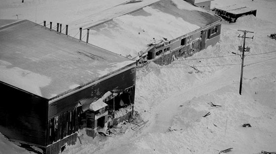
Kangiqsualujjuaq Avalanche Tragedy. The toll was staggering: 9 dead, including 5 children aged 22 months to eight years. 25 more were injured.
Today, the old school "Satuumavik" site has been abandoned and a new school "Ulluriaq" stands in an avalanche-safe area. Kangiqsualujjuaq, QC, 1999. Revelstoke Museum & Archives 5524. © Bruce Jamieson.
Transcript Download MP4 (71.2 MB) Download WEBM (58 MB)
Kangiqsualujjuaq Avalanche Tragedy, Canadian Broadcasting Corporation (CBC) television news broadcast, 1999.
On January 1, 1999, the remote Northern Quebec community of Kangiqsualujjuaq awoke to the tragic news of an early-morning avalanche that came down the mountainside and through the wall of a gymnasium full of people having a party. 5 children and 4 adults died. Courtesy Canadian Broadcasting Corporation (CBC), 1999.
“All I own, I can lose. Nothing can you gain.”
Lyrics to A Father's Song in Peter Freschen's "Book of the Eskimo". Arctic explorer, Freschen collected the words to this Inuit song sometime in the early 1900s. Presented by Tania Peters. © Revelstoke Museum and Archives A2014.1.1.
| Date | Location | Lat, Long | Deaths | Category/Subcategory |
|---|---|---|---|---|
| March 11, 1912 | Tilt Cove, near Baie Verte, NL | 49.883, -114.962 | 5 | Industry | Mining |
For the people in two houses, it was a time of brutal shock as their sanctuaries disintegrated into places of pain and sorrow. Five died including a father, a son, a brother and sister, and a family servant, Emily, who shielded another child from death.
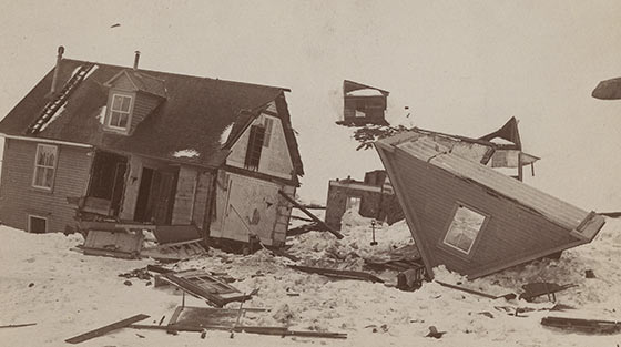
Scenes like this have been repeated many times along the coasts of Newfoundland and Labrador and throughout Canada's avalanche country.
Attacking from the rear, the snowslide caved in walls, tore through rooms and blasted out front windows. A torn roof lay upside down on the snow like a discarded eggshell. Tilt Cove, NL, 1912. Courtesy of the MacKinnon family, Revelstoke Museum & Archives 5538.
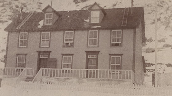
The Williams' house before the avalanche. The slide came from the cliffs behind the houses in this tiny mining community.
After the snowslide ruptured, it was only moments before the Cunningham and Williams' households were shattered in agony and death. Tilt Cove, NL, 1912. © The Rooms Provincial Archives Division, A 24-100, Home of Francis Williams, Tilt Cove / Francis Williams [postcard: before March 1912], Smith family collection. Revelstoke Museum & Archives 5539.
| Date | Location | Lat, Long | Deaths | Category | Subcategory |
|---|---|---|---|---|
| April 3, 1898 | Chilkoot Pass, Crater Lake, BC | 59.70644, -135.22324 | 68 | Transportation | Trails, Roads and Highways |
Chilkoot Pass on the Canada-United States Boundary – April 3, 1898. An endless line of Klondike gold rushers trudging up the steep snow-covered Chilkoot Pass sets the scene for North America's second-worst avalanche disaster on Palm Sunday, 1898. Aboriginal packers warned of the avalanche danger that day. Many stampeders forged on. A series of slides claimed about 68 lives.
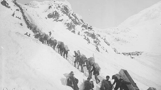
Heavily burdened on a grueling slope, the stampeders were within sight of the Canadian boundary when the avalanches struck.
The Klondikers were on the Alaska (USA) side of the pass when the avalanches hit. © University of Washington, Library, Special Collections AWC3837.
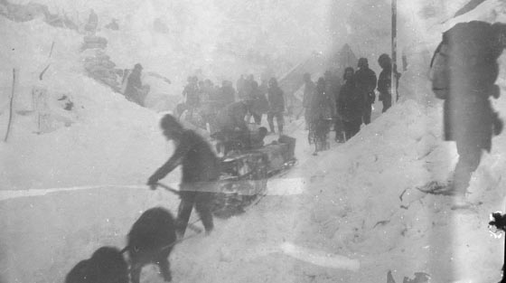
At the summit of the pass, the stampeders crossed into British Columbia, Canada, leaving their greatest exposure to avalanches behind.
Avalanches likely occurred on both sides of the border that day. The next winter, avalanches killed 6 people on the BC side. Chilkoot Pass Summit, BC, 1898. © National Museum of Canada / Library and Archives Canada PA-013498.
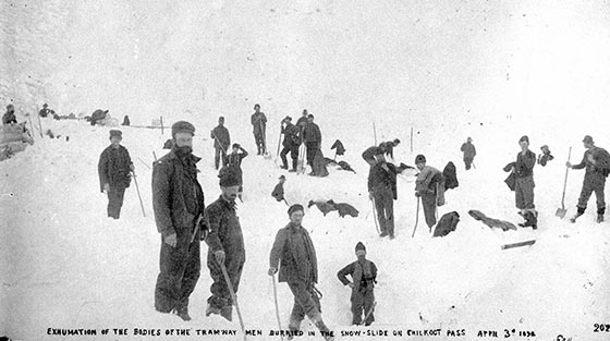
Packs and freight carried by the stampeders would have made searching for survivors difficult. No Aboriginal people were among the victims.
Chilkoot Pass, Alaska, 1898. © Image D-06525 courtesy of Royal BC Museum, BC Archives.c_05172.
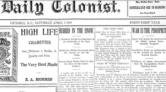
News of the tragedy arrived in Victoria, BC by steamship 5 days after the slides and made newspaper headlines the next day.
The trail over the Chilkoot Pass was known as the Dyea Trail. This story in the Victoria Colonist also mentions avalanche problems along the trail the previous year. © Used with permission of the Victoria Times-Colonist.
| Date | Location | Lat, Long | Deaths | Category | Subcategory |
|---|---|---|---|---|
| Jan 1, 1999 | Kokanee Lake, BC | 49.748, -117.177 | 1 | Recreation | Backcountry Skiing |
When a small avalanche pushed Michel Trudeau onto the thin ice over Kokanee Lake, he broke through while still wearing skis, poles and pack. Unable to reach shore, the crystal-clear waters within the spectacular wilderness sanctuary of Kokanee Glacier Provincial Park became his gravesite.
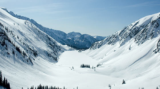
Michel Trudeau's tragic death brought avalanche safety into sharp focus for Canadians across the nation.
Site of the avalanche that claimed the life of Michel Trudeau, youngest son of Canada's 15th Prime Minister, Pierre Trudeau. The avalanche originated in the cliffs on the right side of the lake near the far end in this view. Michel's group was following the trail between the lake and the cliffs. Revelstoke Museum & Archives 5522. © Martin Naroznik.
Transcript Download MP4 (35.4 MB) Download WEBM (33.8 MB)
1998 Canadian Broadcasting Corporation (CBC) television news report on the avalanche tragedy in Kokanee Glacier Park that killed Michel Trudeau on November 15, 1998.
The Trudeau family later helped create the Canadian Avalanche Foundation, a charitable organization financially supporting public avalanche safety. © Canadian Broadcasting Corporation (CBC) Archives A.2013.17.1
Transcript Download MP4 (40.5 MB) Download WEBM (42.1 MB)
The Trudeau family's efforts to educate a snow-bound nation about the risks that skiers and snowboarders take when they cross the "stupid line".
Since Michel's death, the Trudeau family has been a strong supporter of avalanche safety in Canada. Their message is clear: don't cross the stupid line. © Canadian Broadcasting Corporation (CBC) Archives A2013.17.2
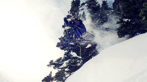
"My brother Michel was the backcountry Trudeau; his was to be a life in and of the mountains…" Justin Trudeau, 1995.
Winter of 1995, Whistler, BC. Revelstoke Museum & Archives, 5565. © Justin Trudeau.
Transcript Download MP3 (1:14 1.7MB) Download OGG (1:14 1.1MB)
We have decided as a family that this is too risky… we do not want to put any other lives at risk, and we are making a recommendation that we stand down on the recovery.” Sacha Trudeau, 1998.
Avalanche professional John Tweedy describes the difficult decision to end the search for Michel Trudeau due to dangerous conditions. Michel Trudeau, youngest son of former Prime Minister, P. E. Trudeau, was killed in an avalanche in Kokanee Glacier Park in 1998. At the time of the accident, Tweedy worked as an avalanche professional in charge of highway safety on Highway 3 through Kootenay Pass, BC. Interview: July 8, 2013, Revelstoke, BC. Revelstoke Museum & Archives A.2013.19. © John G Woods. Photo: John Tweedy, Revelstoke Museum & Archives, 5566. © John G Woods.
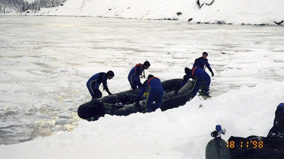
Police dive team search Kokanee Lake for Michel Trudeau several days after the accident, 1998.
Royal Canadian Mounted Police dive team searching for Michel in Kokanee Lake. Kokanee Glacier Provincial Park, BC, 1998. Revelstoke Museum & Archives 5521. © John Tweedy personal collection.
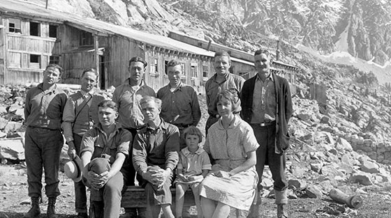
An avalanche killed 9 people at the Molly Gibson Mine above Kokanee Lake on December 25, 1902.
22 people have died in avalanches in the vicinity of Kokanee Lake between 1902-2011. They include 13 backcountry skiers and 9 miners at the Molly Gibson Mine above Kokanee Lake. Molly Gibson Mine, BC, circa 1930. © Image d_06525, courtesy of Royal BC Museum, BC Archives.
| Date | Location | Lat, Long | Deaths | Category | Subcategory |
|---|---|---|---|---|
| February 1, 2003 | Connaught Creek, BC | 51.29536, -117.55214 | 7 | Recreation | Backcountry Skiing |
Revelstoke is no stranger to grieving the loss of life to avalanches. Within two weeks 14 skiers had died in the mountains this community calls home. And while all life is precious, seven were children, the hope of every nation. Their loss would be long-remembered by Canadians as a painful sorrow embedded in a tragic winter.
Transcript Download MP4 (50.4 MB) Download WEBM (47.7 MB)
A school wilderness ski trip becomes a nightmare as an avalanche in the Rogers Pass area of Glacier National Park claims 7 lives.
Two avalanche accidents in 2003 near Revelstoke, BC stunned the nation. 7 backcountry skiers died on January 20th near the Durrand Glacier. 12 days later, 7 teenagers lost their lives below Balu Pass in Glacier National Park. © Canadian Broadcasting Corporation (CBC).
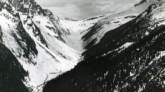
The avalanche struck the school group as they ascended the steeper part of the valley reaching up to the headwall of the valley of Balu Pass.
Connaught Creek leading to Balu Pass has long been a favourite for backcountry ski-touring. Glacier National Park, BC, Revelstoke Museum & Archives PSA-79.
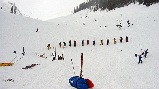
Although all the victims were found with transceivers, rescuers formed a search line probing the avalanche debris as an extra precaution to make sure that everyone was found.
Glacier National Park, BC, Febuary 3, 2003. Revelstoke Museum & Archives 5525. © Parks Canada.
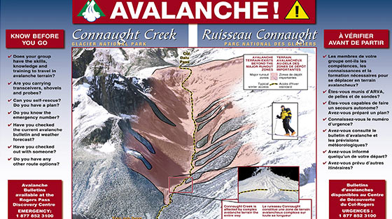
Parks Canada avalanche terrain map for Connaught Creek. Parks Canada developed terrain classifications and guidelines for youth groups in the aftermath of the Connaught Creek tragedy.
After 13 fatal incidents resulting in 29 deaths during the winter of 2002-2003, Canada devoted renewed energy, focus and funding to avalanche safety. Working closely with Parks Canada, Avalanche Canada emerged as a national voice for public awareness and safety. Revelstoke Museum & Archives 5337. © Parks Canada.
| Date | Location | Lat, Long | Deaths | Category | Subcategory |
|---|---|---|---|---|
| January 22, 1974 | North Route Café, 45 km west of Terrace, BC | 54.39113, -129.13106 | 7 | Buildings/Town |
It was a bad night to drive through the mountains. Highway 16 had become a traveller’s nightmare: knee-high new snow at Terrace and more snow to the west. With slides already down, eight marooned people waited at the service centre. With dawn, another avalanche obliterated their refuge. Seven died in the avalanche-churned snow, buried as much as 8 m deep.
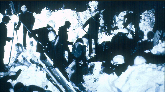
A mix of housing debris, large trees and snow up to 8 metres deep complicated the search at North Route Café, January 22, 1974.
A helicopter spotted the avalanche debris and a rescue mission commenced. Miraculously, 1 survivor was found under 1.5 m of snow after burial of more than 7 hours. January 22, 1974, Revelstoke Museum & Archives 5534. © BC Ministry of Transportation and Infrastructure.
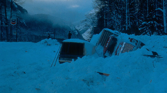
The avalanche destroyed buildings and threw aside vehicles at the North Route Café, 1974.
The avalanche victims included the cafe owner, his daughter, a short-order cook, a machine operator and a highway snowplough driver and 2 stranded travellers. Revelstoke Museum & Archives 5535. © BC Ministry of Transportation and Infrastructure.
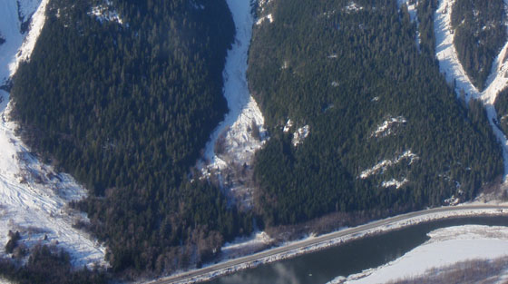
North Route slidepath, 2013. Travellers would have been completely unaware of the huge avalanche path directly above them.
The North Route slidepath is now mapped in a highway avalanche atlas including all avalanche paths that could potentially reach the highway. Revelstoke Museum & Archives 5328, 2013. © BC Ministry of Transportation and Infrastructure, Scott Garvin.
North Route slidepath at highway. Today, vegetation has grown back at the Café site and there is little evidence of the tragedy.
The BC Ministry of Transportation and Infrastructure has mapped over 1400 avalanche paths affecting BC highways. Throughout the avalanche season, their team of avalanche professionals work to keep motorists safe, BC Ministry of Transportation and Infrastructure, Steve Brushey. © Revelstoke Museum & Archives 5526, 2013.
In the aftermath of the North Route Café tragedy, BC launched an extensive highway avalanche safety programme.
Today, avalanche professionals have mapped over 1,400 avalanche paths, including the North Route, and operate an around-the-clock safety programme throughout the avalanche season. Revelstoke Museum & Archives 5527, 2013. © BC Ministry of Transportation and Infrastructure.
Pacific Northwest, February 24 to March 5, 1910 - For ten brutal days, storm-after-storm strode across North America’s western mountains. Extraordinary quantities of snow and rising temperatures fueled an avalanche cycle unparalleled in the continent’s history. The death tally was staggering. Ten slides claimed at least 180 people: 59 in Canada and 121 in the United States.
| Avalanches | Weather | |||||||
|---|---|---|---|---|---|---|---|---|
| to date | today | location (lat, long) |
fatalities today | fatalities to date | location | max temp | total snowfall | daily snowfall |
| 1 | 1 | Rogers Pass, BC (51.2871, -117.5160) |
- | 1 | Rogers Pass | -20 °C | 38.1 cm | 38.1 |
| Cornucopia, OR (45.0127, -117.2135) |
1 | |||||||
| Avalanches | Weather | |||||||
|---|---|---|---|---|---|---|---|---|
| to date | today | location (lat, long) |
fatalities today | fatalities to date | location | max temp | total snowfall | daily snowfall |
| 2 | 1 | Merritt, WA (47.7811, -120.8419) |
- | 3 | Rogers Pass | -13.3 °C | 55.9 cm | 17.8 cm |
| Cascade Tunnel, WA (47.7716, -121.164) |
2 | |||||||
| Telma (47.8400, -120.8144) |
- | |||||||
| Avalanches | Weather | |||||||
|---|---|---|---|---|---|---|---|---|
| to date | today | location (lat, long) |
fatalities today | fatalities to date | location | max temp | total snowfall | daily snowfall |
| 3 | 1 | Katches No. 1, WA (47.2643, -121.2059) |
- | 6 | Rogers Pass | -6.7 °C | 63.5 cm | 7.6 cm |
| Gaynor, WA (47.7805, -120.9372) |
- | |||||||
| Saltees, MT (47.4103, -115.5086) |
- | |||||||
| Saltees, MT (47.4103, -115.5086) |
- | |||||||
| Adair, MT (48.6972, -114.1926) |
3 | |||||||
| Avalanches | Weather | |||||||
|---|---|---|---|---|---|---|---|---|
| to date | today | location (lat, long) |
fatalities today | fatalities to date | location | max temp | total snowfall | daily snowfall |
| 4 | 18 | Bear Creek, BC (51.3323, -117.4516) |
- | 1 | Rogers Pass | 3.9 °C | 88.9 cm | 25.4 cm |
| Gaynor, WA (47.7805, -120.9372) | - | |||||||
| Bern No. 1, WA (47.7661, -121.0016) | - | |||||||
| Katches No.2, WA (47.2643, -121.2059) | - | |||||||
| Mace, ID (47.518, -115.822) | 12 | |||||||
| Bear Gulch, ID (43.6827, -114.2161) | - | |||||||
| Paragon Mine, ID (47.6052, -115.736816) | - | |||||||
| Seedar Creek, ID (47.5944, -115.7963) | - | |||||||
| Fielding, MT (48.2769, -113.4482) | - | |||||||
| Highgate Siding, MT (48.2471, -113.4806) | - | |||||||
| Highgate Siding, MT (48.2471, -113.4806) | - | |||||||
| Drexel, MT (47.327, -115.253) | - | |||||||
| Avalanches | Weather | |||||||
|---|---|---|---|---|---|---|---|---|
| to date | today | location (lat, long) |
fatalities today | fatalities to date | location | max temp | total snowfall | daily snowfall |
| 5 | 1 | Burke, ID (47.3113, -115.4913) |
5 | 23 | Rogers Pass | -1.1 °C | 106.7 cm | 17.8 cm |
| Avalanches | Weather | |||||||
|---|---|---|---|---|---|---|---|---|
| to date | today | location (lat, long) |
fatalities today | fatalities to date | location | max temp | total snowfall | daily snowfall |
| 8 | 3 | Wellington, WA (47.7716, -121.164) |
96 | 121 | Rogers Pass | -1.1 °C | 129.6 cm | 22.9 cm |
| Drury, WA (47.6342, -120.7270) | 1 | |||||||
| Roslyn, WA (47.2250, -121.0030) | 1 | |||||||
| Rogers Pass, BC (51.2871, -117.5160) | - | |||||||
At one location, 98 died in North America’s worst avalanche accident. The avalanche descended on buildings and stranded trains at Wellington on the Great Northern Railway on the west side of Stevens Pass, Washington State, USA.
A mangled rotary snow plough rests amongst the wreckage at the Wellington avalanche disaster. Wellington, WA, 1910. © Washington State Historical Society 1943.42.17467.
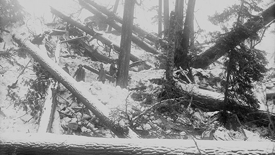
Searchers are dwarfed by huge trees swept down in the avalanche, Wellington, WA 1910. © Washington State Historical Society.
Wellington, WA 1910. © Washington State Historical Society
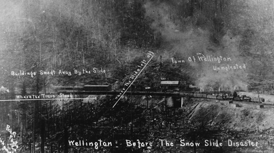
The steep slopes above the Wellington station showed fire-scars and fallen timber, Wellington, WA circa 1910. © Lee Pickett photo, Skykomish Historical Society.
Wellington, WA circa 1910. © Lee Pickett photo, Skykomish Historical Society.
| Avalanches | Weather | |||||||
|---|---|---|---|---|---|---|---|---|
| to date | today | location (lat, long) |
fatalities today | fatalities to date | location | max temp | total snowfall | daily snowfall |
| 8 | 0 | Berne, WA (47.7698, -120.9809) |
- | 121 | Rogers Pass | -4.4 °C | 129.6 cm | 0 cm |
| Red Mountain, OR (42.2868, -118.3179) | - | |||||||
| Avalanches | Weather | |||||||
|---|---|---|---|---|---|---|---|---|
| to date | today | location (lat, long) |
fatalities today | fatalities to date | location | max temp | total snowfall | daily snowfall |
| 8 | 0 | Highgate, MT (48.2471, -113.4806) |
- | 121 | Rogers Pass | 1.7 °C | 147.4 cm | 17.8 cm |
| Avalanches | Weather | |||||||
|---|---|---|---|---|---|---|---|---|
| to date | today | location (lat, long) |
fatalities today | fatalities to date | location | max temp | total snowfall | daily snowfall |
| 9 | 1 | Rogers Pass, BC (51.2871, -117.5160) |
58 | 179 | Rogers Pass | 3.9 °C | 203.3 cm | 55.9 cm |
| Rogers Pass, BC (51.2871, -117.5160) |
- | |||||||
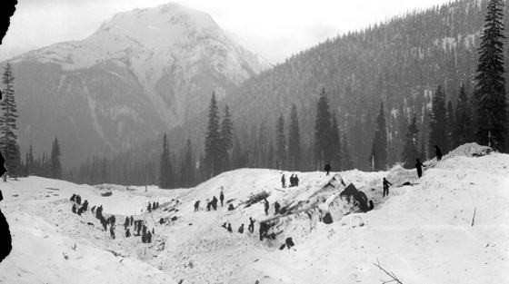
58 die in Rogers Pass, BC in Canada's worst avalanche accident. The fatal slide hurled a rotary snow plough uphill and buried men as they worked to clear an earlier slide across the railway tracks.
The first slide came down Mount Cheops from the west. The second came down Avalanche Mountain from the east. Glacier National Park, BC, 1910. © Whyte Museum V263 6124, Byron Harmon, photographer
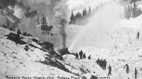
After the slide, men with shovels worked in combination with a rotary snow plough to clear the line.
This rotary plough was working from the east side of the disaster site. Glacier National Park, BC, 1910. © Image d_00187 courtesy of Royal BC Museum, BC Archives
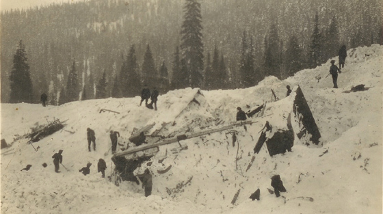
The men hit by the avalanche and their rescuers came from several nationalities.
Thirty-two of the victims were Japanese men working on contract. Some of the men in this view are wearing turbans. Glacier National Park, BC, 1910. © Revelstoke Museum & Archives 257
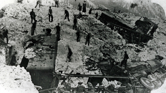
Train passengers stranded at the Rogers Pass station walked under several avalanche paths to view the disaster site.
A family group (top, centre) watch as men dig out a rotary snow plough and steam locomotive hit by the slide. © Revelstoke Museum & Archives 1250
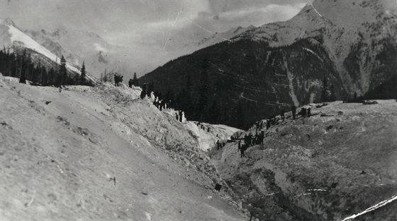
The amount of snow brought down by the avalanche made it very difficult to find the buried men.
This view looks south from the summit of Rogers Pass towards Mount Abbott in the background. Glacier National Park, BC, 1910. © Revelstoke Museum & Archives 2511
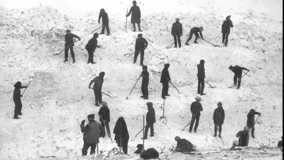
The avalanches left a massive task of searching for victims and clearing snow in Canada's worst avalanche accident.
Canadian Pacific Railway, summit of Rogers Pass. Glacier National Park, BC, March, 1910. © Whyte Museum V263 1659.
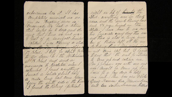
"…We had a storm that lasted for 10 days and during that time we had over 8 feet of snowfall besides slides." John Anderson, Revelstoke, BC, 1910.
John wrote of the storm that changed his life, shocked North America, and sent echoes of sorrow around the world. Revelstoke, BC, 1910. © Royal BC Museum 997.133.1.
Transcript Download MP3 (2:37 2.3MB) Download OGG (2:37 1.2MB)
"When I returned, I found everything buried… Everything was in darkness and the wind blowing hard, and 58 men buried in the slide." John Anderson, Revelstoke, BC, 1910.
Excerpt from an interview with Julie Lawson, granddaughter of roadmaster John Anderson, in Victoria, BC, 2013. © Revelstoke Museum & Archives A2013.8.2, John G Woods.
| Avalanches | Weather | |||||||
|---|---|---|---|---|---|---|---|---|
| to date | today | location (lat, long) |
fatalities today | fatalities to date | location | max temp | total snowfall | daily snowfall |
| 10 | 1 | Rogers Pass, BC (51.2871, -117.5160) |
- | 180 | Rogers Pass | 1.1 °C | 233.8 cm | 30.5 cm |
| Washington Slocan Mine, BC (50.0055, -117.2189) |
1 | |||||||
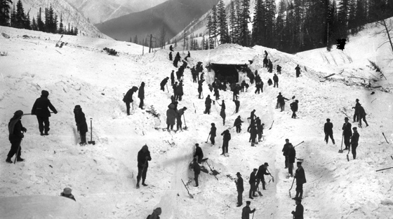
Slides blocked the Canadian Pacific Railway in Canada and the Great Northern Railway in the United States during the superstorm.
Digging out 14 Shed on the Canadian Pacific Railway the day after the fatal avalanche at 17 Shed. Rogers Pass, Glacier National Park, 1910 BC. © Whyte Museum V263 6123, Byron Harmon, photographer
As news of the tragedy spread, grief stretched across both countries and to the homelands of the victims across the Pacific and Atlantic. In Canada most of the deceased were buried in Revelstoke and Vancouver. Thirty-two of the Rogers Pass victims were contract workers from Japan. Multicultural memorials were held in Vancouver, Revelstoke and Rogers Pass on the Centennial of the slide in 2010.
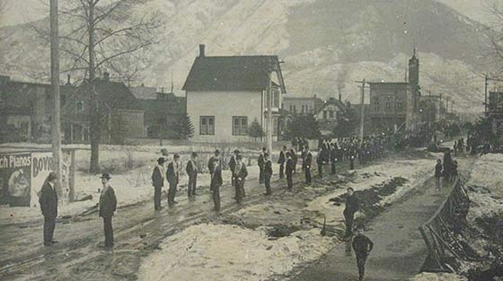
Funeral procession for 58 victims of the Rogers Pass slide held March 18, 1910 in Revelstoke.
14 Rogers Pass victims are buried in Revelstoke, BC. 41 others are buried across Canada from Vancouver, BC to Sydney, NS. 1 person was buried in Wales, UK, 1910. © RBC Museum 980.112.1.
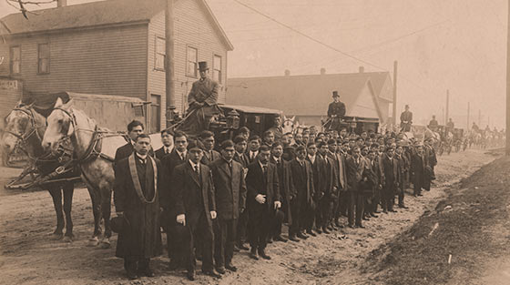
Funeral procession for Masatora Abe, a Japanese contract worker killed in the 1910 Rogers Pass avalanche. Vancouver, March 26, 1910.
34 of the 58 Rogers Pass victims are buried in Vancouver, BC, including 32 Japanese contract workers. Vancouver, BC, 1910. © Revelstoke Museum & Archives 5536, Abe Family Collection.
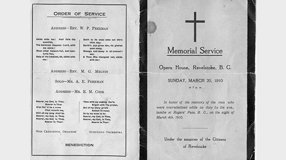
Order of Service for the memorial held at the Revelstoke Opera House on March 20, 1910.
There has been confusion over the number of people who died in the slide. This programme accurately lists all 58 who died at Rogers Pass on March 4, 1910. © Revelstoke Museum & Archives 62.41.7.
Transcript Download MP4 (83.5 MB) Download WEBM (67.5 MB)
Remembering 1910 event, Revelstoke, BC, 2010.
Remembering 1910 avalanche tragedy, Revelstoke, BC, 2010, Revelstoke Museum & Archives A2013.26. © Parks Canada.
These tragedies make the lesson clear: never underestimate an avalanche. Whether large or small, reoccurring yearly or just once in a century, snow avalanches can overwhelm people, vehicles and buildings with devastating power. Knowledge, preparedness, and humility are keys to safety in avalanche country.
North Route Café avalanche on Hwy 16, west of Terrace, BC, 1974.
The avalanche victims included the cafe owner, his daughter, a short-order cook, a machine operator and a highway snowplough driver and 2 stranded travellers. Revelstoke Museum & Archives 5535. © BC Ministry of Transportation and Infrastructure.